| Mission | Submission Guidelines | Editorial Team |
| Issue 1 | Archive |

| Short Reports |
||
| Part 2 |
|
|
|||||||||
|
||||||||||
|
||||||||||
|
||||||||||
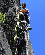
Three-Summit Traverse On August 21st and 22nd, 2003, Kurt Buchwald, Peter Avolio and Martin Volken completed a ridge traverse of all three summits of Bonanza Peak. The traverse involved an approach via the Mary Green Glacier, a climb of the 1978 Northeast Ridge route to the main summit, and a traverse to the West Summit followed by a traverse to the Southwest summit. The descent from the Southwest summit dropped to the Isella Glacier, traversed the glacier to the base of the Holden Ridge, crossed over the ridge and descended down the Mary Green Glacier to Holden Lake. Except perhaps for the relatively easy Northeast Ridge of the Southwest summit, the traverse followed previously climbed terrain. The unique aspect of this climb was the linking of existing routes to connect the three summits. The party bivouacked on the climb near the top of the snow chute on the 1940 Isella Glacier route. The route is a full Cascade adventure in a spectacular setting, climbing on an exposed ridge at over 9,000 feet for many hours. Total round trip movement time from Holden Lake was about 19 hours. Grade V, 5.7/5.8
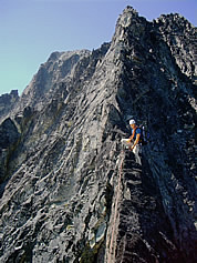
On July 30th 2003, Kurt Buchwald and I completed the ridge crest traverse from Spider-Formidable Col to the summit of Mount Formidable in the North Cascades. From the Spider-Formidable col at 7,350 feet we moved northwest and around a rotten tower on the left into the first notch where the rock was better. We then climbed generally near the crest until the ridge flattened and eased. Next a blocky ridge was climbed on good rock. Staying a bit north of the crest brought us to the top of the first distinct tower. From the tower, we rappelled into the following notch (down climbing possible) on the north side of the ridge, reaching the base of a headwall. Two pitches (5.6 - 5.7 slightly north of the ridge) on good rock and awesome ambiance led up to an easier but exposed and blocky ridge to what we called the “2 County Summit” (Chelan and Skagit Counties). We continued on and over several small towers and gained a horizontal section of walk-able terrain with stunning exposure. Easy terrain led to the next notch and first ideal bail out spot to the south. From the notch a steep and very narrow tower led to a series of lofty gendarmes. These required steep rappels and slower going. Eventually we gained the notch that leads to a distinct summit just east of the Formidable Glacier (another bail out option for either north or south). From the Formidable Glacier col we climbed easily on the crest crossing over the sub-summit on poor rock to the summit proper. This last section took a little longer than the southern ledges described in the Beckey guide, but the scenery is wild and the rock is good. The descent was made down the summit ridge to a distinct couloir heading south. The route can be split into three sections: Section one goes from the Spider-Formidable col to our distinct “2 County Summit”. Section two goes from the 2-county summit to the Formidable Glacier. Section three is the Formidable Glacier to the summit. The second section is certainly the most complex and most time consuming, even though the “hardest climbing” occurs on the first section. The ridge is about 2 km long, involves a lot of exposed 4th to easy 5th class climbing and some pitches of 5.6 to 5.7 in the center. We spent 11 hours moving from the Col to the summit of Formidable and approximately 13 hours from camp to camp. This traverse resembles the Torment-Forbidden traverse in many ways, but with more complicated ups and downs and more bail off options. IV, 5.7. -Martin Volken
Southern Picket Range, Complete Enchainment VI, 5.10+ Paisano Pinnacle, New Route In mid July 2003, Scott Harpell and partner climbed a new route starting at the West Ridge notch. The first pitch turns a corner to climb a steep hand crack, and then up more cracks to a stance below an orange roof. The next pitch goes left on the face with small cracks then up and crosses over the dihederal route, “Rampage,” before heading toward the skyline. From there follow great cracks up to a small roof and turn it to the right via a fingertip undercling to good cracks around a blind corner (belay stance by small tree). Climb 60 meters directly up via hand-sized cracks to an off width with the crux bulge, then more good cracks and a final clean stemming chimney. III, 5.10c Oval Peak, Northeast Couloir, New Route In July 2003 Kristy Sullivan and I left the Oval Creek trail and climbed cross-country through steep forest to the summit of Scaffold Peak. We followed the connecting ridge toward Oval Peak until it became exposed, then dropped east off the ridge into the basin above the unnamed 7,138-foot lake. We climbed the northeast couloir of Oval Peak next to the steep northeast face of the peak (I-II, 50 degrees). This route is distinct from the older north couloir route which climbs the north side of the peak from Duffy Lake Basin. -Gordy Skoog
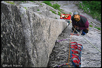
(Photo also at top of page) Chris Greyell, Mark Hanna, David Whitelaw, July, 2003. This six pitch climb is found on the far left side of the Witch Doctor Wall on Exfoliation Dome, a sub-wall known as Solar Wall. It ascends from the talus, immediately above a small rib of forest, to the crest of the dome about 300 yards north of the summit. IV, 5.10b A2 Jacob’s Ladder, New Route Matt Perkins, with Darin Berdinka, Todd Budden, Joe Catellani, Chris Greyell, Mark Hanna, Erik Neumann, Erik Snyder, Chuck Spiekerman, and others; FFA: Rod Fox, Jason Gunderson, July 2003. This eight-pitch climb is found more or less in the middle of the Blueberry Hill side of Exfoliation Dome. It starts near the left side of a broad, low angled apron below the face, and ascends to the Blueberry Terrace, 1,000 feet off the ground, where several other Blueberry Hill routes converge and the usual ascent route thereafter trends leftward toward the N. Ridge of the dome, 100 yards north of the summit. III, 5.11c or 5.10b, A1
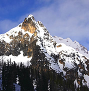
Poster Peak is shown on the Washington Pass quad as point 7565’, located one mile southeast of the Early Winters Spires. It is the terminating high point of the long but mostly flat ridge extending toward Copper Point from the Early Winters massif. The locals named the peak, which is very striking from most angles, after it was used on a ski poster and everyone wanted to know where it was. In the summer of 2003, Poster Peak saw ascents by two probable new routes. Larry Goldie and Blue Bradley climbed the leftmost of the two prominent east-northeast buttresses, as seen from Highway 20 just below the hairpin turn. This high-quality moderate route makes for a great day out, with a one-hour approach. It traverses onto the nose of the buttress from the left on a broad ledge 200 feet up and left from the toe. From there, staying true to the ridge crest on delightful, sound rock will take one right to the summit in about 12 pitches, with the most difficult near the summit at 5.7. This route is of higher quality than the often overcrowded South Arete of South Early Winters Spire. Consider it a good alternative on a busy summer day. Descent is by walk-off to the south and down to the base of the route. Its name is tentatively “Blue Buttress.” Grade III 5.7. (In photo, it follows the buttress directly facing the viewer.) Steve House free-soloed the rightmost of the two east-northeast buttresses in 45 minutes. The climbing is less continuous than on Blue Buttress, but is 5.9 at its hardest. Protection is a bit hard to find in spots. Staying on the crest as much as possible takes one up several steps and across two significant notches. The route begins in a shallow depression on down-sloping, awkward climbing for the first pitch. Two pins are fixed on the first pitch. Subsequent parties have reported as many as 17 roped pitches. The climbing quality is lower than that of the Blue Buttress. Descent is same as for above. Grade III 5.9. (In photo, route follows right skyline ridge in sun.) -Scott Johnston
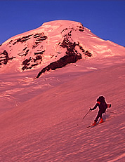
On June 16, 2003, Josh Stern, Jim Cronan and I skied the High Level Orbit route, which was first pioneered by Ben Thompson, Don Henry and Darroch Crookes in 1932. Their original route skied from the Mt. Baker Lodge to Kulshan Cabin, where they waited out a storm for two days, then crossed the Thunder Glacier to the deep canyon below the Deming Glacier. On their eighth day, the weather again deteriorated and they were forced to descend below timberline and hike out 14 miles to civilization. The remaining history of their route is unclear; whether their route or a variation using the Colfax saddle was ever completed is unknown. From a camp on Heliotrope Ridge, we climbed to Colfax Saddle between the Coleman and Deming Glaciers. We cramponed and skied a descending traverse on softening corn to the ridge separating the Talum and Boulder Glaciers. Some climbing over volcanic choss led to the Boulder Glacier and a descent around the Boulder/Park Cleaver. An ascending traverse around crevasses on the Park yielded a fine descent to the flats of the Mazama Glacier (to approximately 6,200 ft). We skinned over the ridge between the Mazama and Roosevelt Glaciers, admired the fine view of the upper Roosevelt and North Ridge, then skied across the Roosevelt and Coleman to return to our camp, 13 hours after leaving it. This fine route provides unusual views of this familiar volcano. The descents are well-spaced and enjoyable. -Matt Peters
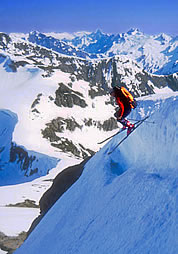
From June 5-8, 2003, Jason Hummel and Ben Manfredi made the first ski traverse from Hannegan Pass to Perfect Pass via the Mineral Mountain high route. On the first day they hiked to Hannegan Pass, traversed the north slope of Ruth Mountain on skis and descended to Chilliwack Pass. The climb from Chilliwack Pass to Mineral Mountain required “survival bushwhacking” on exposed wet cliffs. They passed over the top of Mineral Mountain, descended to Mineral-Easy saddle, and climbed to a camp on Easy Ridge. On the second day, they descended below Perfect Impasse and climbed to Perfect Pass. They climbed and skied Whatcom Peak and camped that night at the pass. On the third day, they made a ski-climb of Mt. Challenger and skied two sub-peaks west of its summit, camping again at Perfect Pass. On the fourth day, they descended from Perfect Pass and traversed Easy Ridge to Mineral-Easy saddle. They skied into Easy Creek and traversed talus, brush and forest to pick up the Easy Ridge trail. They forded the Chilliwack River and followed the Chilliwack trail over Hannegan Pass and to their car at Ruth Creek. Hummel completed the exit hike in his ski boot liners, having lost a tennis shoe on Mineral Mountain. The object of this outing was a climb and ski descent of Mt. Fury. The Mineral Mountain high route was chosen as a shortcut in preference to the Chilliwack Valley trail. Due to the difficulty of the route, the pair abandoned Mt. Fury on this trip, but returned a week later from the Ross Lake side to climb and ski it. (See 'Cascade Steeps' article in this issue. Note that Whatcom Peak and Mt. Challenger were skied in June 1989 by John Dittli and Scott Croll during a Mt. Watson to Whatcom Pass ski traverse.) |
|
||||||||||||||||||||||||||||||||||||||||||||||||||||||||||||||||||||||||||||||||||||||||
| Continued <<Prev | 1 | 2 | 3 | Next>> |
|||||||||||||||||||||||||||||||||||||||||||||||||||||||||||||||||||||||||||||||||||||||||
| ©2004 Northwest Mountaineering Journal | |||||||||||||||||||||||||||||||||||||||||||||||||||||||||||||||||||||||||||||||||||||||||
| Site design by Steve Firebaugh |
)
)
;)