 |
 he
2005 season for wilderness operations in the North Cascades National
Park was notable for what it lacked: snow, major lightning-caused
wildfires, and major search and rescue (SAR) incidents. he
2005 season for wilderness operations in the North Cascades National
Park was notable for what it lacked: snow, major lightning-caused
wildfires, and major search and rescue (SAR) incidents.
The 2004-05 winter snowfall was one of the lowest on record, and for
the third year in a row the park’s glaciers recorded a negative
balance, losing more snow and ice in the summer than they gained in the winter.
Cool June weather perhaps saved the glaciers from melting even more.
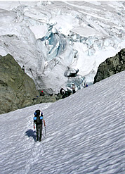
However, glacier surface ice was observed by rangers and park
geologists much earlier than in the past. During one glacial monitoring
session on the Sandalee Glacier (on the north side of McGregor Peak),
a geologist recorded that the glacier was only 15 feet thick in places—much
thinner than expected. In the last 150 years, the park’s glaciers
have lost 40 percent of their mass. An interesting, though less scientific,
observation made this year was that the large (formerly regarded as “permanent”)
snowfield just outside the Copper Lookout, staffed by fire crew or park
rangers since the 1940s, completely melted away by late summer. The snowfield
is the lookout’s water source, and this is believed to be its first disappearance.
 |
 |
|
Mt. Shuksan. Photo © Kevork Arackellian |
|
 |
Trail and Bridge Access Restored, But Not Stehekin Road
Park trail crews spent much of 2005 rebuilding the major bridges lost in
the October 2003 floods and patching up many sections of flood-damaged trails.
As of this year, all major bridges slated for replacement have been completed,
including Stillwell, lower Thunder Creek, Fisher Creek, and Thunder Creek
at McAllister. The Stehekin River Road remains partially closed, however,
due to severe flood damage. In September 2005, the road was repaired and
re-opened as far as Car Wash Falls (about two miles upriver from High Bridge,
or 12.8 miles from Stehekin). The park recently released a draft Environmental
Assessment (EA) for the upper Stehekin Valley Road, outlining four alternative
road actions. The park’s preferred alternative (and the environmentally
preferred alternative) is to close the upper road at Car Wash Falls and
turn the remaining 10 miles of road into a foot and stock trail. More information
on the Upper Stehekin Valley Road EA can be found here.
Staffing
In 2005, 11 rangers plus four full-time volunteers, almost all seasonal
employees, patrolled 610 documented hours to 28 different cross-country
zones. As is standard, many of these multi-day trips were to popular weekend
mountaineering objectives—the standard routes on Mount Shuksan,
Boston Basin peaks, Eldorado Peak, and Mount Triumph. Other patrols included
both the North and South Pickets, the “Inspiration Traverse,”
the Chilliwack Range (Mount Spickard, Mount Redoubt, Bear Mountain), Bacon
Peak, Mount Blum, Colonial Peak, Davis Peak, and The Triad.
Climbing Visitation
This year’s data is presented as number of people, rather than number
of parties (as was submitted to last year’s edition of this journal),
because this better reflects the actual number of feet hitting the ground.
Interestingly, while trends in the number of parties do show a decrease
for some zones over the last few years, the same is not consistently true
for the number of visitors, which has actually increased for some areas,
or remained about the same. This indicates that the average party size
has increased for some areas. In Boston Basin, for example, evaluation
of average party size shows a gradual increase from 3.0 in 2001 to 3.6
in 2005. This doesn’t suggest a huge difference in mountaineering
trends in our estimation, but is likely a result of a slight increase
in both commercial and organized group use of such areas. This statistic
varies by cross-country zone, however, so no overall trend is readily
apparent.
| |
2001 |
2002 |
2003 |
2004 |
2005 |
| Boston Basin |
627 |
628 |
631 |
668 |
630 |
| Colonial |
52 |
104
|
47 |
36 |
87 |
| Eldorado |
458 |
493 |
435 |
467 |
359 |
| Goode |
57 |
51 |
75 |
21 |
17 |
| Klawatti |
133 |
94 |
86 |
44 |
28 |
| Logan |
67 |
56 |
57 |
26 |
27 |
| Sahale Glacier |
626 |
517 |
617 |
415 |
613 |
| Sulphide Glacier |
789 |
638 |
607 |
685 |
628 |
| Terror Basin |
67 |
45 |
55 |
36 |
56 |
| Triumph Col |
44 |
68 |
66 |
61 |
46 |
Fee System for Backcountry Permits
In 2005, permit system managers at North Cascades, Olympic, and Mount
Rainier National Parks were directed to design a fee system for backcountry
permits that was consistent with park operations and that carried the
same fee in each of the three parks. While both Olympic and Mount Rainier
already have fee and/or reservation systems, this was to be a big change
for operations and for visitors at North Cascades National Park. After
reaching consensus about a fee program for the three parks,
management direction changed; any new program is now on hold until
at least 2007. The three parks continue to “do their own thing,”
with distinct fee/reservation programs in place at Mount Rainier and Olympic,
while North Cascades continues using a system with required, but free,
permits.
This management discussion has stimulated an effort at North Cascades
to get the word out about the reason for the backcountry permit requirement,
through the park’s annual handout, publications such as Climbing
Notes, various backcountry and climbing websites, and the park’s
own improved website. The North Cascades National Park backcountry permit
system is focused on wilderness management and data collection and, at
least through 2006, is not a revenue generation system. It remains required,
but free.
Mountain Goat Study
Wilderness rangers assisted the start of a mountain goat research project
designed to improve the park’s ability to estimate mountain goat
populations and detect future population changes. Mountain goats are native
to the North Cascades. Over the last few decades, goat populations have
declined substantially in many parts of their native range, including
within the park, but a lack of data has hampered researchers in assessing
the magnitude of declines. In 2005, the park started a joint research
project with Olympic and Mount Rainier National Parks, as well as the
United States Geological Survey and the Washington Department of Fish
and Wildlife. Currently 21 goats are radio-collared in Washington,
including four collared in the northern end of North Cascades National
Park in 2005. The collars on the goats enable researchers to track the
goats’ movements and develop a better research model for tracking
goat populations.
Waste Management
2005 had no composting toilet casualties, but the Thunder Basin composter
was replaced. Rangers maintained 16 composting toilets in subalpine or
alpine sites. In various areas without toilets, particularly at the Sulphide
Glacier camp on Mount Shuksan’s south side before toilet melt-out,
rangers dealt with 63 incidents of improper feces disposal. The permit
centers gave out nearly 1,000 blue bags for use in carrying out waste
in early season or from climbers’ camps without toilets. Staff noted
a trend in recent years toward familiarity and acceptance of the blue
bag system—i.e., most climbers know what blue bags are and are comfortable
using them. Just a few years ago, blue bags were received with many puzzled
or disgusted looks. Several major guiding companies now supply their clients
with commercial versions of the blue bags, which probably helps increase
the public’s general awareness of human waste issues.
Glacier Study
Again in 2005, as for at least a decade, climbing rangers assisted the
park’s geologists with the glacier mass-balance study, traveling
to the Silver, North Klawatti, Noisy, and Sandalee Glaciers. As noted
earlier, the year was not good for glaciers.
Search and Rescue Training and Incidents
In June 2005, six rangers and three pilots practiced and certified for
STEP landings (commonly referred to as one-skid, hover, or power-on landings)
in preparation for helicopter exits to rough or technical terrain. The
standard refresher courses were held for high-angle rock rescue. Climbing
and patrol staff also used Mount Baker’s Easton Glacier as a
training site for crevasse rescue.
 |
 |
|
Magic Mountain Summit. Photo © Rosemary
Seifried. Enlarge |
|
 |
The North Cascades National Park SAR program continues to work toward establishing
an Aviation Management Directorate (AMD)-approved helicopter short-haul
program certification, tentatively slated for June 2006. Another effort
to increase SAR program effectiveness has been the addition of two high-quality
volunteers, a paramedic and an emergency room physician who is also the
medical program director for Skagit County. In addition to medical expertise,
the two have strong mountaineering backgrounds. They began involvement
with the National Park Service through volunteer patrols with climbing
rangers, eventually being on-call for SAR. Even when unavailable to physically
respond, the benefit is great to rangers and patients to have “medical
control” by telephone or radio dispatch to a physician familiar
with mountain rescue conditions. North Cascades National Park rangers
involved with SAR are certified as EMT-B.
All in all, the 2005 season was very odd in terms of search and rescue activity.
While the number of incidents was significantly low for the season,
the highest fatality mountaineering accident in park history
tragically occurred in July 2005. Then, after an unusually quiet August,
one of the most difficult helicopter evacuations in recent memory was
successfully undertaken responding to a fluky accident on flat ground.
A long-recognized tenet of the search and rescue business is to make
no assumptions about anything.
Nine incidents occurred which required an evacuation or field response
by rangers. These were almost all minor knee or leg injuries, involving
litter carry-out or helicopter evacuations. Three incidents are
briefly summarized in the sidebar.
|
 |
| Search
& Rescue Highlights |
|
Sharkfin
Tower, July 10
A party of six attempting Sharkfin Tower’s SE Ridge ascended
a non-standard approach gully, then attempted to traverse high
to the tower. Party-inflicted rockfall hit one member, resulting
in a non-critical injury, and forced the party to retreat. On the
top rappel, down the same gully used for the approach, two climbers
rappelled individually without incident. Catastrophic anchor failure
then occurred as the next two climbers began a rappel with the injured
climber attached between them. A fourth climber, meant to rappel
last, was tied into the anchor. The anchor rock either slid or overturned
and the four climbers went with it to the bottom of the gully, approximately
300 feet. The two mid-gully climbers partially witnessed the fall
and were not hit. Three climbers died in this fall; one was critically
injured. The rescue response was hindered by poor weather and notification
near sunset, but completed during the night and into the next day.
This accident is believed to be the first multi-fatality climbing
accident in the park in a couple of decades. It also provoked a
great deal of after-incident analysis and reconstruction by ranger
staff, more than any incident in recent memory, to determine what
exactly happened and why. A full analysis was submitted to Accidents
in North American Mountaineering.
Copper Ridge, September 11
After a full week of trail and cross-country exploration across
the north unit of the park, a party of two was on the last night
of their trip, camping on Copper Ridge. Just before dawn, one stepped
out of the tent, tripped, and fell onto a tent stake, which impaled
several inches into muscle below the knee. Carrying a satellite
phone, the physician in the party requested evacuation, reporting
profuse bleeding, pain, and immobilization. Serious weather complicated
the evacuation, with the helicopter setting down at several locations
due to potential stranding in fog. After a day-long effort to reach
the patient, he was evacuated to a Bellingham hospital. There he
spent a week, enduring two multi-hour surgeries to repair the damage
from the head of the T-shaped tent stake wrapped around leg arteries.
Mount Shuksan, September 27
Two climbers were reported two days overdue from Mount Shuksan’s
Fisher Chimneys route. Rangers searched by helicopter and found
the climbers’ camp gear at the base of the chimneys, but a
thorough aerial search of the intended route found no sign of the
climbers. Upon expanding the search area, the climbers were found
walking the Baker Laker road, on the opposite side of the mountain.
A follow-up interview found that while one climber had early season
experience on Mount Shuksan, they were not prepared for the significantly
different conditions of late September. The leader stated that the
ascent was “dangerous and scary” for them and it was
“over their heads” to descend to their camp, so they
followed the moderate Sulphide Glacier down. |
| |
|
 |
|


