|
|
||||||||||||
 |
|||||||||||||
 |
|||||||||||||
|
|||||||||||||
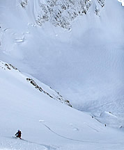
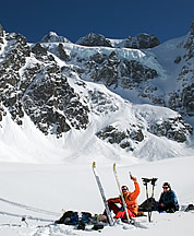
On September 26, 2007, James Hamaker and I climbed the West Face of Molar Tooth, near Rainy Pass. Although Molar Tooth has many routes, particularly on the East Face, the west side had been neglected, probably because it is inconspicuous from frequented viewpoints, lacks an obvious climbing line, and the peak has a reputation for loose rock. Arriving at the base with no concept of what we might find, we discovered a line of weakness on the central part of the West Face. A 40-foot slab at the base led to the first belay at a larch tree. The first roped pitch traversed slabby rock up and right to an exposed 5.7 step-across move below a smooth bulge and a second belay at a dead tree. The next pitch started up a wide, shallow chimney leading to 5.8 face and crack climbing. The central portion of this pitch is a huge boulder formation with a hand crack behind it (5.6) that required down-climbing the opposite side, then continuing to a ledge area above. The third pitch climbed very clean, easy fifth class rock to a rubble slope and a final short chimney with an overhanging chockstone (5.7). We spent 3-1/2 hours of roped climbing to cover the 400 vertical feet of the route. Grade II, 5.8 -Robert Campbell Mount Higgins, SE Slab, Ski Descent From the Stilliguamish River Valley between Arlington and Darrington, the steeply tilted slabs on the south side of Mount Higgins present a curious sight. On February 17, 2008, Phil Fortier and I climbed and skied the broadest of these slabs from the 4680ft+ sub-summit SE of the true summit of Higgins. From Swede Heaven, we were able to drive to around 1,400ft before hitting snow. In this vicinity, we found the road gated. We traversed several miles west on a logging road until we found the correct clearcut. Fortunately Phil had printed out an aerial forestry photo, showing the precise clearcuts down low, enabling us to gauge where to begin the trek uphill. Low on the slab, we found that the snow had fractured and buckled without releasing, creating several crevasse-like features that we had to cross. The snowpack was only two to three feet thick and water was running on the smooth rock slab underneath. The upper part of the slab featured a few inches of powder topped by a thin crust. Fortunately, during the descent our skis didn’t make contact with the hard ice layer underneath that we noticed on the ascent. Snow conditions were quite variable depending on sun exposure and avalanche debris. Back at the highway we noticed that a point-release slough came down sometime after we skied, wiping out some of the tracks. -David Coleman (The opening photo on this page shows ski tracks on Mount Higgins.)
Mt Shuksan, North Face, NW couloir variation, Ski Descent On February 28, 2008, Eric Wehrly and I skied the North Face of Mount Shuksan with a variation on the lower part of the face. We left the White Salmon Lodge at the Mount Baker ski area at 5:00 a.m. and climbed the North Face to the North Shoulder, the logical start for a ski descent of this route. We went light on this climb, reckoning that the vast majority of our time would be spent where 1. avalanche risk is negligible or 2. an avalanche means certain death. No beacon, shovel, or probe; this is how we get high. Rope? Pro? If we can’t do it with an ice axe and crampons, then it’s not worth skiing. A pleasant warm-up slope began the descent from the North Shoulder. The North Face featured an acceptable wintry alpine mix. Windboard, packed-and-chundered powder, with only the occasional icy bump. The views were better than ever with the white cloak of winter on everything. During the approach we had noticed the major couloir that branches to skier’s left from the lower North Face toward the base of the NW Couloir. We discussed climbing it, but opted against that because of our lack of helmets. The steep couloir hangs above cliffs with exposed exit maneuvers. I was nervous above the entrance. It had a patch of ice. Would it be icy and runneled in there? No, it was mostly packed powder with softening sunny slopes below. A narrow exit gully allowed passage through rock bluffs at the bottom of the couloir. By 1:30 p.m. we were celebrating my 29th birthday back at the White Salmon Lodge. -Sky Sjue
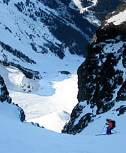
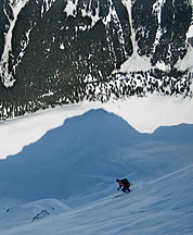
Bandit Peak, NW Couloir, “Black Hole,” Ski Descent On March 2, 2008, Phil Fortier and I climbed and skied Bandit’s NW (“Black Hole”) Couloir in powder snow conditions. Having drooled over John Scurlock’s photo since it first came online, I sent Phil an email on Saturday asking if he’d be up for an attempt on Sunday. I knew he’d be interested since he asked Scurlock to take photos of Bandit in the first place. We left Seattle at 3 a.m. Sunday morning and were skinning from Napeequa Crossing by 6 a.m. In about three hours we skied the roughly six miles to the base of the route. The couloir runs 4500ft from top to bottom, with the bottom 1000ft being a slightly convex apron that hides the terrain above. As we started climbing, we weren’t certain we were in the right place, but Phil got us in position. Finding six inches of light powder at 3000ft, we were excited; when we crested the lower apron and saw a 3500ft lane of steep snow above us, we were ecstatic. From that point to the top we climbed through powder from shin to thigh depth. We dug a snow pit half-way up and were satisifed with the snow conditions we found. We booted the entire couloir except where the snow was too deep to walk. In those places we switched to skins for frustrating 15-ft switchbacks. The climb from the valley floor to the top took six hours. Phil didn’t like the top 50-or-so feet and he waited while I scampered up to peer over the other side. Weather was approaching so I didn’t wait long before clicking into my skis. I billy-goated down to Phil to discuss strategy. The safety zones on Bandit are spaced rather far apart so we decided to ski each section fast. The snow was perfect—deep, sluffless powder. We descended 3500ft in 15 minutes, including stops for pictures. The combination of snow quality, scenery, steepness, continuity, and terrain made our descent one of the best in my life. The valley ski went smoothly and we reached Phil’s car 14 hours after leaving it. -Ryan Lurie
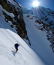
Mount Shuksan, Curtis Glacier On March 5, 2008, I skied the Curtis Glacier of Mount Shuksan with Sky Sjue and Mattias Zeigler. Leaving Seattle at midnight, Sky and I arrived at the Mount Baker Ski Area parking lot at 3:30 a.m., where we met Mattias. We skied over Austin Pass and eventually arrived at Lake Anne. The previous day had been warm, exposing all west and south slopes to direct sun and leaving them slick and ravaged by wet slides. Looking toward Baker Lake, we determined that our primary objective for the day, the SW Couloir, which I would later ski with Jason Hummel, was in poor condition. Instead, we made a rising traverse toward the Lower Curtis Glacier to investigate other possibilities. Steep and icy conditions in an avalanche ravine forced us to switch to ice axes and crampons to reach the spectacular amphitheater that holds the Curtis Glacier. We traversed to the south side of the glacier looking for a way up that would provide a satisfying ski down. When Sky reached the far side, he pointed his pole northeast at a sublime 1800-ft couloir tucked beneath the icefall of the Upper Curtis Glacier. Worries about calving seracs were ever-present during our climb up the couloir, but views of Mount Baker and our immediate surroundings on Mount Shuksan inspired us to continue. We reached our 7600-ft high point on the glacier as the late-morning sun touched the snowfields above and around our line. We completed our descent in excellent powder conditions and passed the crux at about 6000ft quickly to minimize exposure to icefall. Shortly after we left the couloir, snow started moving all over the mountain and we enjoyed the show as we reveled in the beauty of a classic line on a beautiful mountain. -Davide De Masi
|
|
|
||||||||||||||||||||||||||||||||||||||||||||||||||||
<< Previous | 1 | 2 | 3 | 4 | 5 |
||||||||||||||||||||||||||||||||||||||||||||||||||||||
| ©2008 Northwest Mountaineering Journal | ||||||||||||||||||||||||||||||||||||||||||||||||||||||
| Site design by Steve Firebaugh |

