|
|
|||||||||||||||
 |
||||||||||||||||
 |
||||||||||||||||
|
||||||||||||||||
|
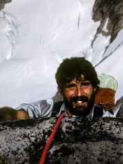
I was asleep, probably having that dream where you suddenly realize that you have neglected to attend a class that you’re enrolled in for a period of weeks and now you’re hopelessly behind. This unpleasant dream was interrupted by the sound of someone singing outside my tent. I opened my eyes and looked at my watch: Five a.m.! Why was John standing outside of my tent in the Boston Basin ranger camp at five in the morning singing, and how the hell did he get here? My partner To understand why, you’d have to know John. I knew him fairly well after working with him all summer, but was still surprised that he’d showed up this morning. He had to have left Marblemount at about three a.m., because it takes a couple of hours to drive up the Cascade River Road and hike in to Boston Basin in the dark.
But it all made sense because John Dittli loves the mountains. He loves to climb them, loves to photograph them, and loves to ski on them. Driven by his passion for life in the mountains, John artfully combined three gigs into a seasonal lifestyle that kept him busy and happy. In the winter, John lived and worked at Tamarack Lodge, a Nordic skiing resort outside of Mammoth Lakes, California. At Tamarack, John was a jack-of-all-trades. Possessing a wide range of skills, his responsibilities included driving the snow cat to groom the cross-country ski trails, patrolling trails on skis, and performing assorted maintenance tasks around the lodge. John held a blasting card, and was responsible for avalanche control, setting hand explosives to reduce slides that could block the road to the lodge. Come spring, when the Sierra Nevada was well into thaw, John would load his gear into his red Toyota pickup and migrate north to Washington for the summer climbing season. His first National Park Service job was at Mount Rainier, where he worked one season as a climbing ranger at Camp Shurman. That position served as a good introduction to the “work”—and I use that term with the understanding that to many, the job of a climbing ranger resembles anything but work. At Shurman, rangers monitor the daily traffic of climbers slogging up and down the Emmons Glacier route. Over the summer, John became intimately familiar with the finicky stove in the ranger hut, the toilet, and the dirt, rock, and snow that represent the immediate landscape around Camp Shurman. When the weather was good, John and his ranger partners took turns patrolling the northeast side climbing routes. When the weather was bad, there was the hut, the finicky stove, the toilet—you get the picture.
After one summer on Rainier, John took a job as a backcountry ranger in the North Cascades National Park. His first posting was at Whatcom Pass. Due to its remote location and the fact that camping is not allowed at the pass, most visitors hike right through without stopping to linger. From his base camp north of the pass, John spent days exploring, mapping, and photographing the surrounding meadows, ridges, and lakes. The landscape lent itself to solo exploration on foot, and John was not bothered by the isolation of his outpost. Distribution of backcountry patrols in the North Cascades National Park changed in the early 1980’s with the arrival of Bill Lester as Wilderness District Ranger. Previously, the backcountry rangers patrolled trails through the major valleys, such as the Chilliwack River, Big and Little Beaver Creeks, the Cascade River, and Bridge Creek. When Lester arrived, he saw that the biggest threat to the wilderness resource was vegetation damage in the fragile subalpine meadows especially evident at Cascade Pass, but also visible in other subalpine meadows such as Whatcom Pass, Copper Ridge, and the high trails and passes of the Stehekin District. Lester moved the backcountry rangers to patrol bases on the passes, where they could better manage visitor use and monitor impact. Additionally, routine weekend patrols were scheduled for Shannon Ridge on Mount Shuksan, Thornton Lakes, Monogram Lake, Eldorado Basin, and Boston Basin. A major priority for these patrols was to monitor visitor use and promote minimum-impact travel and camping. After John left Whatcom Pass, I spent several days at the ranger camp patrolling and read John’s daily patrol log from his two seasons there. His entries were filled with detailed descriptions of weather, wildlife, landscape, and occasional visitor contacts, and reflected John’s deep appreciation for the place. This minor literary treasure even contains a carefully hand-drawn map of the area around the Pass on the inside of the logbook. John labeled geographic features with his own place names: In Between Basin, Tiny Lake, Secret Pond, and The Last Meadow. This map served to orient rangers that followed John to the Pass and its surroundings.
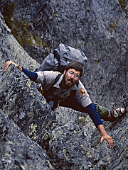
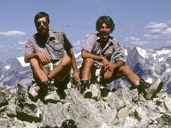
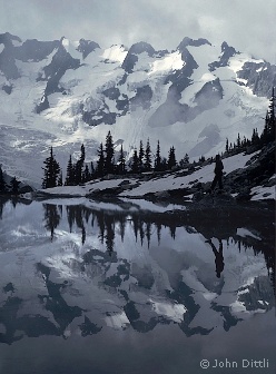
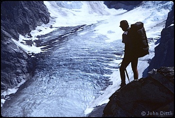
The manuscript was never meant to be published and was stored in the metal footlocker in the ranger camp. I know that other Whatcom Pass visitors that had read John’s logbook had the same reaction and I wonder where it is now—perhaps filed away in the wilderness district office in Marblemount. I believe it would be worthwhile to publish, as the insights of a sort of backcountry Thoreau. But, perhaps its value has been enhanced in my memory and it was best appreciated by the few who came across it in its native environment. John was (and is) also a very serious photographer whose images appeared in Wilderness and Outside magazines, the Black Diamond catalog, and the Moon Calendar. During all of our travels in the mountains, he carried his trusty Olympus camera, usually with an extra lens or two. This was remarkable considering the weighty loads we routinely packed for climbing patrols. After adding a climbing rack and rope to our backpacking load, which included hefty first aid kits and park-issued walkie-talkies with spare batteries, John would toss in camera lenses and lash on a tripod. He never shirked carrying his share of our group gear, and his pack loads were routinely prodigious. Despite being burdened with such loads, John set a fast pace in the mountains. I generally found myself trying to keep up, although pace was never a bone of contention. In fact, we were well-matched in terms of ability and interest and developed a sympathetic rapport. We understood each other’s priorities and communicated effectively. Co-workers who observed our relationship occasionally commented that it was if John and I could read each other’s minds. That’s how I understood why John was standing outside my tent in the Boston Basin ranger camp at five a.m. I knew that, like me, John was feeling a bit anxious about the end of the season, and wasn’t ready to let go without one more big climb. That’s what drove him to set his alarm for three a.m. and set out by headlamp to Boston Basin. A climbing ranger’s life
John fired up a kettle while I dressed in the tent, and we ate hastily in silence as the morning light began to rise in the basin. Our destination was the north side of Forbidden Peak. We were both very familiar with Forbidden, having climbed it from all sides, but there remained a particularly attractive route that we had been eyeing for some time, and that route was to be the day’s objective. As climbing rangers, John and I enjoyed a great deal of autonomy in our daily tasks, and we balanced the Park goals of wilderness management with our climbing motivation to explore new terrain. On busy weekends, we patrolled areas with high climber traffic: Mount Shuksan, Eldorado Peak, and Boston Basin. The selection of midweek patrol objectives was, for the most part, up to us. At the beginning of each summer, John and I would draw up a tick list of target destinations. The list included peaks, specific climbing routes, high traverses, or remote backcountry areas that had not been visited by park staff for some time. Once the tick list was established, we could select a destination at any point that was appropriate to seasonal conditions, weather, and our disposition at the moment. Early season trips were executed on skis, and we carried our telemark boards on patrols of Eldorado Peak, Boston Basin and the Sulphide Glacier on Mount Shuksan, A trip to Pelton Basin to dig out the ranger camp was made much quicker when the descent back to the parking lot followed a direct ski line. John had an eye for high ski traverses and he and I skied from Hidden Lakes Peak to Tricouni Peak, with ski descents of Eldorado, Austera, and Tricouni en route. John’s most ambitious ski trip was a five-day traverse with fellow backcountry ranger Scott Croll from Baker Lake to Beaver Pass via Bacon Peak, Green and Berdeen Lakes, Jasper Pass, the Challenger Glacier, and Wiley Ridge. This was a classic example of picking a line off the map and launching into the unknown, acting on faith that they would be able to connect the dots and make the route go.
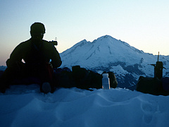
I also came to realize that John occasionally suggested destinations based on another motive: full moon photography. John tracked the lunar calendar and strategically planned our high camps to capture images of the full moon rising over the peaks. He often sat up in his sleeping bag, tripod-mounted camera next to him, with a shutter release cable in his hand, patiently waiting for moonrise. Being a less-serious photographer, I carried a little Rollei 35 viewfinder camera. By watching John capture images with his tripod-mounted camera and pointing my own little snapshot camera at the same targets, I learned useful lessons about photography. Given that it was late in the summer, with a perfect weather forecast, our selection for the day was the Northwest Face of the North Ridge of Forbidden Peak. This apron of ice follows a direct line above the Forbidden Glacier to gain the North Ridge at its mid-point. From there, we planned to follow the North Ridge to the summit and then descend the West Ridge back to Boston Basin. The face’s position on the north side of Forbidden made it impossible to examine from Boston Basin. Since we had no idea what condition the ice would be in, we each carried ice gear, including a second ice tool and screws. Indeed, we would not know what we were in for until we actually gained the face. After a quick breakfast, we shouldered our packs and started climbing toward Sharkfin Col. The slabby rock shelves and boulder fields above the Boston Basin climbers’ camps are a series of Zen gardens with braided streams splashing down from the Quien Sabe Glacier. Bright bundles of yellow and pink monkeyflower bulge from cracks in the rock, lending contrast to the monochromatic polished gray diorite. Mats of moss with slender stalks of saxifrage and fringed grass of parnassus perch alongside streams of water draining the glacier above. We wended our way upward as the sky lightened to the east, hopping streams and boulders as we avoided treading on the delicate vegetation. |
|
|
||||||||||||||||||||||||||||||||||||||||||||||||||||||
| Continued 1 | 2 | Next>> |
||||||||||||||||||||||||||||||||||||||||||||||||||||||||
| ©2010 Northwest Mountaineering Journal | ||||||||||||||||||||||||||||||||||||||||||||||||||||||||
| Site design by Lowell Skoog | ||||||||||||||||||||||||||||||||||||||||||||||||||||||||
