|
|
 |
|
| Camp on the High Divide at the end of the first day on the Bailey Range traverse in June 1989. (Sketch map. Click photos to enlarge.) | |
|
Nineteen eighty-nine
was a busy year for me as a mountaineer. I explored new routes
in the Cascade Mountains on Forbidden Peak (the Forgotten
Spurs) and Kimtah Peak (East Face), repeated classics such as
the Complete North Ridge of Mount Stuart and the East Buttress
of South Early Winters Spire, and was successful climbing Mount
Waddington, the monarch of the British Columbia Coast Range.
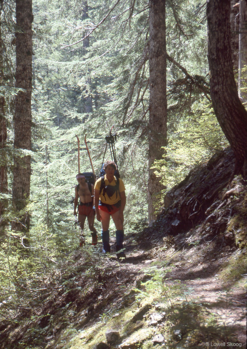
On skis, I explored high routes through the Chiwaukum Mountains, across the Buckindy Range, and from Sulphur Mountain to Glacier Peak along a path we called the Suiattle High Route. Most of these outings in the Cascades were scheduled around weekends, since I was immersed in my engineering career, having graduated from the University of Washington at the end of 1978. The finest ski trip I did in 1989 was a traverse of the Bailey Range in the Olympic Mountains, starting at the Soleduck River and circling the Hoh River valley via the High Divide, Bailey Range, and Humes and Hoh Glaciers. The trip culminated with an ascent of Mount Olympus and was completed over five days, from June 1 to June 5. The weekend preceding this trip (May 27-29) was one of the wettest Memorial Days in a decade. Two feet of snow fell in many parts of the Cascades and the Northwest Avalanche Center issued a special avalanche warning for considerable hazard. Since the Olympics were not in the main path of the storm, my friends Joe Catellani, Jens Kieler, Brian Sullivan, my brother Carl and I decided to try for the Bailey Traverse a few days later. At 5am on June 1st our group departed from my house in Seattle to catch the 5:40am ferry from Edmonds to Kingston. After driving to the Soleduck road entrance, we unloaded most of the party and then Carl and I drove to the Hoh Visitor Center. There we filled out a backcountry permit with a skeptical ranger. “You going to do all that in five days?” he asked. “You know there's a lot of snow up there. I don't think anybody skis over there in the Bailey Range.”
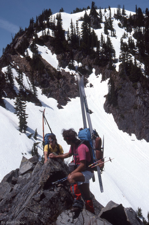
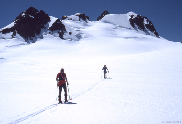
After assuring him that we were familiar with trips like this in the Cascades, he added, “Well the Olympics are different. There are lots of whiteouts this time of year.” We thanked him for his counsel and decided to have a look for ourselves. Carl left his car at the Hoh Ranger Station and we headed back to the Soleduck River. Around noon on June 1, we began hiking the Soleduck, some of us walking in tennis shoes, others in boots. Where the trail turned south and began climbing toward Heart Lake, snow patches became more prevalent and by 4300 feet in elevation there was deep snow in the basin. We put on skis and continued ascending Solduc Park to the High Divide. Stopping for the night, we admired the view of Mount Olympus across the Hoh Valley. Mount Ferry and the southern Bailey Range peaks that we planned to traverse looked far away. There was no running water near the divide so I descended back to the basin to gather some and save time melting snow. The next morning, we began skiing east along the High Divide toward Cat Peak. The snow cover became intermittent as we went, and where the ridge steepened we concluded it was time to begin traversing the southwest flank of the peak on foot. The faint trail was essential for crossing this steep, gritty slope.
Pausing for a photo, Carl accidentally dropped his 24mm lens (fortunately in a homemade case) and it tumbled 400 feet down this nasty slope. He went searching for it and caught up with us about an hour later. After a food break, we angled up toward the ridgeline south of Cat Peak. Then we followed the crest to “The Catwalk,” a rocky section of ridge with scrubby trees. The main obstacle of The Catwalk was dense brush that snagged our skis. Following The Catwalk we made the biggest route error of the trip, traversing the southwest flank of Mount Carrie instead of climbing to the summit of Carrie and crossing to the northeast side of the range. From that point we could have traversed relatively gentle, open country past Stephen Peak before crossing back to the west flank of the Bailey Range and continuing southeast toward Mount Ferry. (See map.) Carl and I discovered our error after dropping our packs and skiing to the summit of Carrie. But by the time we got there, the rest of the party had continued traversing the southwest flank, and we had to descend to retrieve our packs and catch up with them. Traversing toward Cream Lake was a hassle—lots of sidehill gouging, gullies, stubby trees and dirt. We ended up camping on a shoulder around 5200ft about a mile west-southwest of Stephen Peak. Jens had continued farther east but we couldn’t tell where. He camped at a spot where he could see us and rejoined us at Cream Lake the next morning.
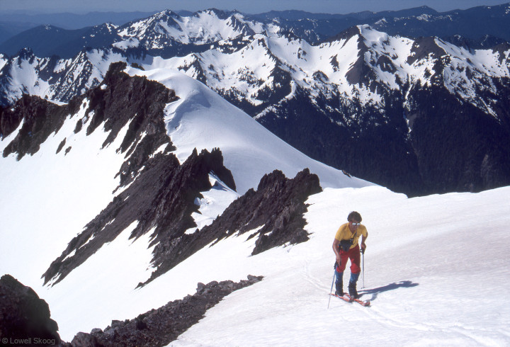
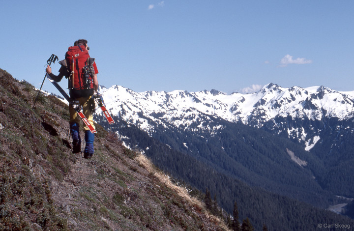
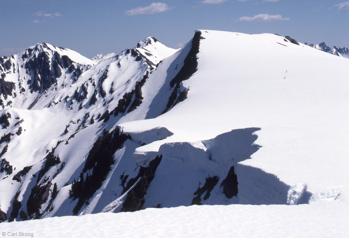
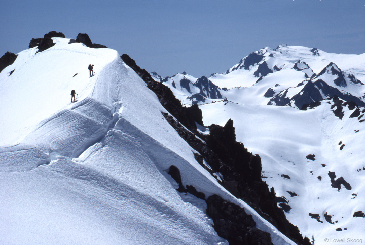
After more low-elevation hassles on our third morning, we entered Ferry Basin and observed how easily we could have skied from the southeast ridge of Steven Peak to this point. We admired pretty lakes below Mount Ferry, including a large one that didn't appear at all on my old 15-minute topo map (dated 1956). The next section of the route was perhaps the finest of the trip. We skied right along the crest toward Mount Childs (Point 6193ft). At one spot, I stood on a bump and watched the others climb along a knife edge right in line with Mount Olympus. The scenery was as fine as any ski traverse I had ever done. As the rest of the group skied ahead, I dropped my pack and scooted up Mount Childs (point 6205ft on my old topo map, now measured at 6193ft.) I was able to ski up and down the little peak, and I rejoined the group near the head of Queets Basin. After descending the basin, we contoured west toward Humes Glacier, encountering a gorge at the head of the Queets River. We avoided it by climbing up and traversing above the gorge through trees (with blazes) until we found an easier descent into the stream channel. Reaching Humes Glacier, we encountered zillions of snow worms. We found running water just below Blizzard Pass, so I filled a water bag and carried several pounds of water up the final slope to our camp. On the morning of our fourth day, most of the party waited for the sun to reach our camp. Carl and I decided to rise early and climb Mount Circe (6847ft) for views of the dawn. I was feeling underfed since the exertions of Day Two, so when we returned to camp, I crawled back into bed to get some more rest. I resolved not to skimp on food on the next trip.
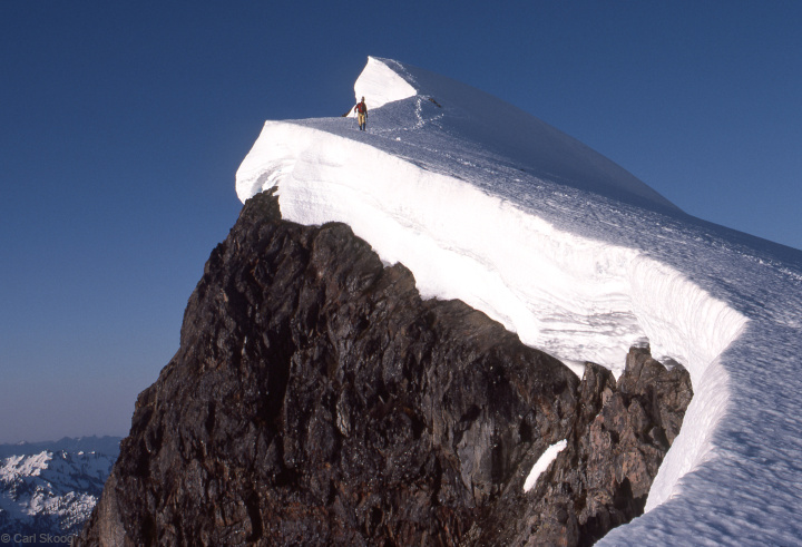
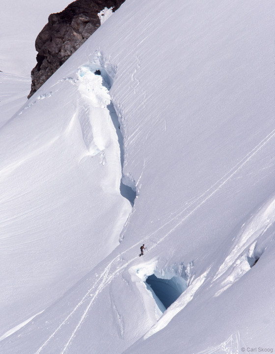
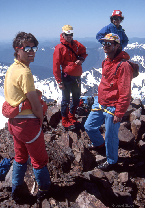
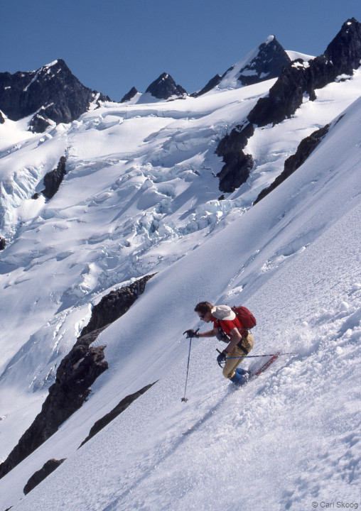
In mid-morning we skied to the Hoh Glacier and then climbed to Glacier Pass. We celebrated a little here, having completed the Bailey Traverse section of our trip. We glided down to the Blue Glacier, with Carl and I making telemark turns on our Ramer touring bindings. We dropped packs below the Snow Dome and sorted the few items we’d want (including a 165-foot 8mm rope) for the summit of Mount Olympus. During our ascent of the early season route, we rather blithely crossed a large snowbridge that looked frightful when we looked down at it later from the summit. Apparently we were the first climbers of the season. A solo climber from the Mount Olympus glaciology hut came up to work on his suntan and check us out. Three hikers followed somewhat behind. Around 3pm we rappelled back to the snow and skied back to our packs. We found sticky snow up high, but excellent below the Snow Dome. We continued down to Glacier Meadows and hiked to a buggy camp at Elk Lake, around 6:30pm. On our fifth day, we rose early to beat the heat and try (unsucessfully) to beat the bugs. We hiked in boots to Olympus Guard Station and switched to tennis shoes from there to Hoh Visitor Center. The skeptical ranger was quiet this time, though he did seem curious about our experience. We spent the rest of the afternoon retrieving our car on the Soleduck River and making our way home to Seattle. We agreed that the Bailey Range traverse was a superb ski trip that could be made even better by traveling high on the divide between Mount Carrie and Stephen Peak (or along its east flank). Mount Olympus is beautiful in any season, but most of all when cloaked in the gleaming snow fields of spring. —Lowell Skoog, July 2024
|
||||||||||||||||||||||||||||||||||||||||||||||||
| The Alpenglow Gallery |