
|
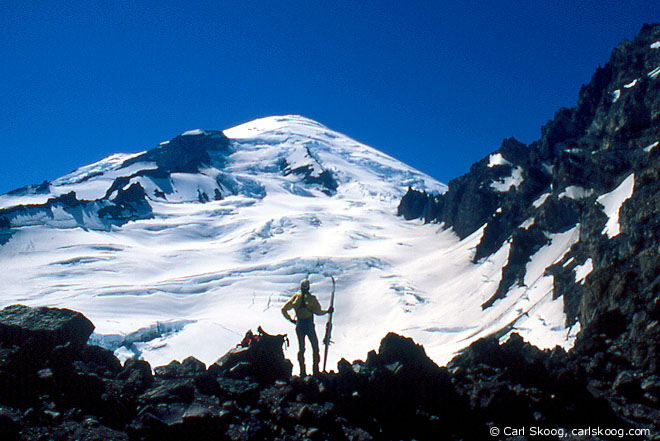
| On the Ingraham-Whitman Glacier divide below Mount Rainier, 1996. (Map, 400kb) |
|
Today's Cascade backcountry skier may be surprised to learn that there was once a developed ski area at Cayuse Pass. In the late 1930s, the Washington State Highway Department began plowing the road to the pass in winter from the north. During the 1937-38 season, 34,000 people used the area for winter sports, despite the fact that there was no shelter and no sanitary facilities. In 1949-50, four rope tows were installed southeast of the pass, linked in series to the slopes near Tipsoo Lake. Nine years later, the Ohanapecosh highway was paved and the pass was maintained as a thru-route in winter for the first time. The opening of the Crystal Mountain Ski Area in 1962-63 reduced the popularity of Cayuse, but the little ski area kept running and the road was plowed in winter to provide access from Enumclaw to White Pass. In 1974, during the OPEC "gas crisis" the Highway Department closed Cayuse Pass due to low usage. It has generally been closed in winter ever since.
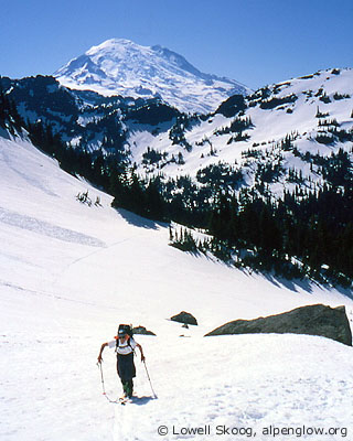
Today, Cayuse and Chinook Passes are backcountry skiing destinations mainly in late spring. Chinook Pass traditionally opens on Memorial Day weekend. Cayuse opens sooner, but being lower and more heavily wooded, it doesn't offer as much nearby skiing as the more alpine slopes of Chinook Pass. Yet the country west of Cayuse Pass is pristine and seldom visited. Governors Ridge, Owyhigh Lakes, and the Cowlitz Chimneys are not especially remote, but they're often overlooked by skiers attracted to the more popular spots on the east side of Mount Rainier National Park, places like Summerland, the Interglacier, and Sunrise. In the 1930s, Dwight Watson and Sigurd Hall scouted ski terrain that even today is considered off the beaten track by well-traveled backcountry skiers. In 1937, they traversed from Cayuse Pass over Governors Ridge to the Cowlitz Chimneys country. Watson also made several trips to this area from Fryingpan Creek and Summerland. Watson was both an avid photographer and a practical joker. During one of his Summerland trips he packed a little Coca Cola girl -- a cardboard cutout made to sell soda pop -- and got his ski partner to pose for the camera with his "girlfriend" on the slopes of Mount Rainier. I climbed the main peak of the Cowlitz Chimneys with my brother Carl in June 1991, approaching from Fryingpan Creek on skis. But I never thought of traversing this country until I heard about a Mountaineer party skiing the route in about 1999. Soon it was on my list of trips to do. I was attracted by the extensive travel above timberline and the possibility of bumper-to-bumper skiing -- starting at the bumper of a car parked at Paradise and ending at the bumper of another car parked at Cayuse Pass (see map, 400kb). For a late spring trip, the Cayuse Pass to Paradise traverse has remarkably little hiking. The elevation profile of this route favors skiing from west to east. In this direction, most of the climbing is done early, on the way from Paradise to Anvil Rock. From that point on, long gentle descents are common, with short, stiff climbs between them. Done west to east, the traverse offers plenty of gliding on skis.
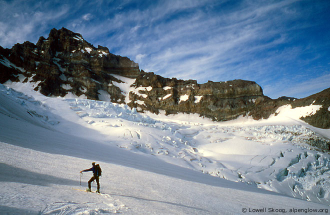
In late May, 2001, Garth Ferber and I set out to do this trip. A foot of new snow had fallen in the mountains about a week earlier, and we hoped the southern Cascades would have more consolidated snow than the peaks farther north. We drove separately to Cayuse Pass and parked a car there. Then we circled around the east side of Mount Rainier and took the Stevens Canyon road to Paradise. It had been a light snow year and the typically high snowbanks along the parking lot at Paradise were almost nonexistent. We started toward the Muir Snowfield in early afternoon, taking a leisurely pace over this familiar terrain. At the top of Anvil Rock we took a break. I decided to go over the top of Anvil instead of contouring its east flank to avoid traversing steep, mushy snow above crevasses. We descended onto the Cowlitz Glacier and crossed to its north edge. We skied down the glacier a bit, then crossed Cathedral Rocks to the Ingraham Glacier. We roped up and skied across the glacier to the Ingraham-Whitman divide. After scrambling a few hundred feet of volcanic rock, we reached the crest of the divide, our camp for the night. It was a relaxed first day, about five hours traveling from Paradise. The sun soon passed behind the great bulk of Rainier, but the evening was warm and calm and we found comfortable spots to lay out our sleeping bags and cook dinner. The night was clear and moonless. The next morning, I got up around 5 a.m. to take pictures of the sunrise. As the sun climbed above the horizon, the glowing dome of Rainier changed colors from purple to pink to gold and finally to dazzling white. Around 7 a.m. we left our bivi site and began skinning up the Whitman Glacier headwall on Little Tahoma Peak. The snow was well frozen and I soon removed my skis and put on crampons. Garth had brought ski crampons (harscheisen) and managed to ski to the highest edge of the snow, around 10,700 feet. We stashed our skis and scrambled the last few hundred feet to the summit. At 11,138 feet, Little Tahoma is the third-highest major summit in the Cascades and a grand viewpoint. But it is so overshadowed by Rainier that it is often forgotten. The summit is an airy place, with the north face plunging over 1,500 feet to the Emmons Glacier, just a stone's throw away. The summit rocks are so undercut on the north side that one begins to worry about the stability of the whole structure. Little Tahoma is also a historic ski mountaineering peak, first skied in April 1933 by Paul Gilbreath and J. Wendell Trosper, who both later competed in the famous Silver Skis races on Mount Rainier.
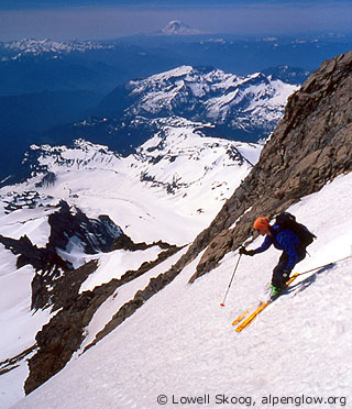
Around 10 a.m. we began our descent. The morning sun had warmed the upper snow slopes and we found excellent, steep corn snow skiing. We returned to our bivi site to rest and pack up, then got underway with our overnight packs across the Whitman Glacier. We glided and skated, holding elevation as much as we could while continuing to move rapidly. We contoured to the Fryingpan Glacier crest, then descended along the crest to Panhandle Gap. It was wonderful to see how far we had traveled from the summit of Little Tahoma with so little time and effort. We climbed and traversed the gentle divide east of the gap, then took a break at the head of the East Sarvant Glacier. We faced a choice here. From Chinook Pass I had seen an alluring steep chute that descends east from the saddle between the highest Cowlitz Chimneys. We decided not to go that way, out of concern for avalanche swept slopes and unpleasant access to the chute. Instead, we enjoyed a long descent of the Sarvant Glacier and climbed to a 6000-foot saddle just south of Tamanos Mountain. From the saddle we skied down to the pass above Owyhigh Lakes then climbed to a notch in Governors Ridge just north of Barrier Peak. The day was hot and still, and we stopped for a break at each of our high points along the way. We skied into the Boundary Creek drainage and encountered the only messy section of the traverse, a delicate creek crossing and some brush due to low snow cover. Fatigue grew in the hot afternoon as we climbed through the woods to the 5200-foot notch west of Cayuse Pass. Descending from the notch, we skied to within ten feet of the paved highway and walked across the road to our waiting car. Memorial Day weekend was just getting started. Holiday traffic was roaring up the highway over Chinook Pass as we packed up. We retraced the drive up Stevens Canyon to Paradise to retrieve our other car, then stopped for burgers in Eatonville on the way home. With scenery and solitude and a marvelous summit climb of Little Tahoma, the traverse from Paradise to Cayuse Pass had proven to be a classic outing. --Lowell Skoog
|
||||||||||||||||||||||||||||
|
Previous | Next | Overview - Skiing the Cascade Crest | The Alpenglow Gallery |


