
|
| Paul Ekman crosses Lake Basin early on the Crystal Mountain to Naches Pass traverse, March 2007. (Map, 400kb) |
|
After skiing from Naches Pass to Stampede Pass alone in February 2007, I posted a note on turns-all-year.com describing my Cascade Crest ski project and seeking partners for future segments of the crest. Paul Ekman responded enthusiastically. I met Paul in February 2006 when I led a tour organized by The Mountaineers along the Snoqualmie Pass to Stampede Pass Patrol Race route. I was impressed by Paul's obvious experience and his efficiency as a skier. I learned that he had done many trips in the areas I wanted to ski and he already had some of the crest routes on his to-do list. He was the perfect partner, solid and easy-going, yet just as motivated as I was to complete these trips. As a climber, Paul understood that commitment and flexibility are the keys to mountaineering success.
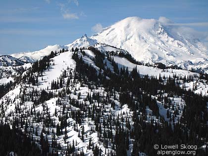
Map study suggested that the route from Crystal Mountain to Naches Pass should be reasonable as a day trip, if done from south to north. More than most sections of the Cascade Crest, this segment has a definite "grain," with most of the climbing done in a short distance from Crystal Mountain to Boy Scout Pass. From Boy Scout Pass to Naches Pass, the route is mostly a gentle descent, with small climbs. Skiing from south to north would be vastly easier than the other way around. In late December, 2006, I made a feeble attempt on the traverse with two friends, starting from Crystal Mountain. It was feeble because the unconsolidated early-winter snow was completely unsuitable for fast travel. We trudged from the ski area to Scout Pass and trudged a bit farther to Big Crow Basin. Our progress was so slow and exhausting that we called a halt only three miles into the trip. It was a humbling reminder of how important snow conditions are for cross-country skiing. The trip was valuable as a reconnaissance, and the following day I skied alone up the road to Naches Pass to scout the other end. I concluded that the trip should be done late enough in the season to have spring-like snow conditions, but not too late. Lying in the snow shadow of Mount Rainier, the Crystal Mountain to Naches Pass traverse melts out sooner than most sections of the Cascade Crest (see map, 400kb). I also concluded that navigating in forest along the snow-covered Crest Trail could be difficult. For the first time in my mountaineering career, I saw value in having a global positioning system (GPS), so I went out and bought one. Heavy rain fell in the Cascades during the second weekend of March, 2007. A cold snap followed in mid-week. Paul and I set our sights on Friday, March 16, hoping that the cold weather would freeze the wet snowpack deeply and that the weather would be decent. We were rewarded with a day that far exceeded our expectations.
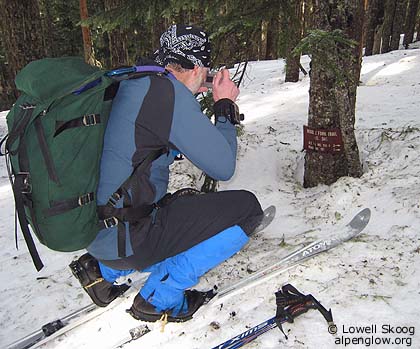
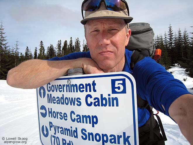
At 3 a.m. Paul and I drove separately from Seattle, meeting in Greenwater. We parked Paul's car at the Pyramid Creek sno-park and drove mine to Crystal Mountain. By 6 a.m. we were underway, skinning up East Peak by headlamp. We found excellent snow conditions. Wednesday's cold storm had firmed up the base. An inch of new snow on top, wetted by rising freezing levels, provided good traction for climbing and traversing. We removed our skins at Scout Pass and traversed Lake Basin, Big Crow Basin, and Little Crow Basin without skins on an efficient, high-level contour. Paul motored along on his fish-scale nordic skis. On my alpine skis, I negotiated the ups and downs with side-stepping and "stiction." We reached Martinson Gap by 9:30 a.m., putting the steep, sunny slopes behind us. As we traveled northward, the crest gradually descended and became more forested. We saw no trail markers except for a sign at Louisiana Saddle. Navigating in the woods on the poorly defined crest with no visible reference points would have been slow and difficult without the GPS. Paul carried his own GPS unit and we compared readings as we skied. The snow on the crest near Louisiana Saddle was deep. We found a lane through the trees that marked the Crest Trail and we enjoyed a fast skating glide through the woods to Rods Gap. The southern Cascades have been extensively logged, but this section of the crest is protected within the Norse Peak Wilderness Area. We enjoyed the quiet and solitude of skiing through one of the few old-growth forests in this section of the Cascades. In mid-afternoon, we reached the Naches Pass snowmobile trail system. Nearly 70 miles of forest roads are groomed regularly in winter near Naches Pass to provide enjoyment for the snowmobilers. We gave a friendly wave to the few sledders we saw (it was a weekday) and we took advantage of the well-packed road to glide from the pass toward Pyramid Creek. The last 1-1/2 miles to the sno-park was melted out, so we walked. We felt lucky to be able to ski as much of the road as we did. The car shuttle was painless, and the next day, after we were comfortably back home, the rains returned. I can hardly imagine better conditions than we found on this trip. --Lowell Skoog
|
||||||||||||||||||||
|
Previous | Next | Overview - Skiing the Cascade Crest | The Alpenglow Gallery |


