|
|
||||||||||||
 |
|||||||||||||
 |
|||||||||||||
|
|||||||||||||
|
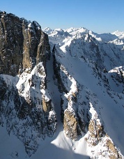
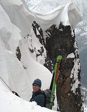
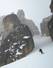
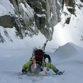
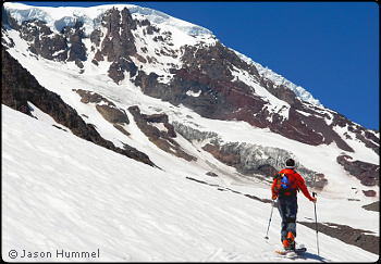
On April 27-28, 2008, Ryan Carter, Paul Kimbrough, Davide De Masi and I climbed and skied the SW Face of Mount Shuksan from Mount Baker Ski area. In 1999, I first attempted this route with Ben and Troy Manfredi and my brother Josh. We opted that time to ascend a nearby ridge instead of the southwest couloir. Due to conditions that day, we decided to descend even further southwest, far down the Sulphide Glacier. I believe this was the “far southwestern face” that Asahel Curtis and W. Montelius Price climbed in September 1906 during Mount Shuksan’s first recorded ascent. Returning again in April 2008, I planned to climb the direct route, which ascends 4300ft out of the valley via the high cirque easily seen from Lake Ann or Shuksan Arm. Climbing deep, wet snow in the early morning hours, we wound our way through lower cliffs onto easier slopes. The snow wasn’t as soft higher up and we were able to make better time. Once on the Sulphide Glacier, due to warming temperatures, we did not climb to the true summit. The ski down was on windslab that softened to mash potatoes. After skiing the route, we ascended back to Lake Ann and up to Shuksan Arm before returning to Mount Baker Ski Area in the rain. -Jason Hummel Tower Mountain, NE Couloir, Ski Descent On May 3, 2008, Tom Janisch drove from Wenatchee and I drove from Seattle and we met at Rainy Pass on the North Cascades Highway. We placed cars on either side of the Cascade Crest then started skiing up Swamp Creek. After a night of clouds with a light freeze, we found walkable crust in places, soft mush in others. We left our skis at the base of the West Face of Tower Mountain and scrambled to the summit on crampons. After returning to our skis from the summit, we climbed a snow gully leading to the top of the NE Couloir. I expected a cornice at the top, so we carried a light rope and rappel gear. At the notch, we found the north side draped with snow flutes and mushrooms, like fluffy meringue. The cornice wasn’t too big and the couloir below looked moderate. We were glad the day was not too hot, and it started to snow a little. We looped a sling around a rock horn and I rappeled over the edge. Wallowing in soft powder, I swarmed over a snow mushroom then moved to the side after touching down. Tom joined me and we put our skis back on and pulled down the rope. We found old powder in the couloir, not super light but quite skiable. The couloir was wide and the setting was grand. After descending about 1000 feet, the couloir opened onto broad slopes below the NE Face of Tower Mountain. We descended into Cataract Creek, skinned to the pass with Pine Creek, then skied down Pine Creek to our second car at the Lone Fir campground. -Lowell Skoog Mesahchie Peak, Mesahchie Icefall Couloir, Ski Descent On May 4, 2008, Timothy Byrnes, Tobae McDuff, Damien Romanik, Sean Walsh and I skied the Mesahchie Icefall Couloir from the East Ridge of Mesahchie Peak. We camped at the Easy Pass trailhead the night before hoping the clouds would give way to a clear night and a deep freeze. It did not happen. The skies cleared during the night, but it was not cold enough to freeze solid. We left the car a little after 5 a.m. Skinning through trees and up to Easy Pass, we found slightly breakable crust, but not bad. From Easy Pass we ascended a few hundred feet to start the traverse towards Mesahchie Col. Ski crampons were helpful here as the snow was hard in places making the traverse a bit sketchy. As we climbed above Mesahchie Col we watched several avalanches sweep the SE flank of Mesahchie Peak and run clear down to Fisher Creek. Both our options for climbing the peak, the South Rib and SE Gullies, were deemed too dangerous due to this hazard. We stopped at about 8100ft, where the couloir above the Mesahchie Icefall meets the East Ridge. We decided to ski the couloir. The 50-degree entrance was protected by cornice on one side. The upper part appeared to have a windslab so we belayed a skier to check it out. A four-inch slab released easily. We had great skiing down to about 5400ft on the Mesahchie Glacier. There we met another party who recommended the best route to ski out to the highway. Good creamy butter for a long ways. -Oyvind Henningsen Colchuck Peak, NE Couloir, Complete Ski Descent At 12:30 a.m. on May 4, 2008, Monika Johnson, Ryan Lurie, Eric Wehrly, and I began hiking the last 1.5 miles of the Mountaineers Creek Road. Ryan and I had recently become interested in Colchuck Peak’s NE Couloir when we noticed good snow coverage on its upper portions en route to a failed attempt to ski the Triple Couloirs on Dragontail. The majority of the NE Couloir was skied in 2003 by Jason and Josh Hummel with Ben Manfredi, but they stopped and made their descent from where the climbing difficulties increased. We finished the route by taking the path of least resistance to the climber’s left where the main couloir ends. The principal difficulties were a short rock step and a cornice at the top. I provided a belay for the others with a 7mm diameter, 20m segment of “magic spaghetti” after breaching the cornice. To begin the descent, we each made a rappel through the cornice using the magic-spaghetti cord. I improvised a two-step dance, equal parts sidestepping and downclimbing with skis, to get through the rock band after accidentally committing myself via an inopportune slabby sidestep. The others followed my recommendation of a change to crampons for a short downclimb. Below the short rock step, the remainder of the couloir featured steep turns in stable powder—we were handsomely rewarded for our early start. -Sky Sjue
Sundial Peak, ESE Face, Ski Descent On May 24, 2008, the first day of the Memorial Day weekend, Phil Fortier and I returned to Royal Basin in Olympic National Park to ski Sundial Peak. Sundial is the 7200-ft peak at the end of the SE ridge of Mount Clark in The Needles. We had eyed a couloir on the SE flank of Sundial during our respective trips to Mount Deception and Mount Mystery a year earlier. We left the trailhead at 8 a.m., reaching Royal Basin before noon. After a quick lunch break, we began booting up the face. The route climbs a snow apron to a chute which opens up into the middle part of the face. Above, the route doglegs left to climb the upper face toward the craggy summit. The lower flanks were a bit runnelled due to avalanching, but smooth enough for skiing. Conditions for booting were excellent on the upper east face. We climbed a snow finger to the ridge just north of the summit but decided not to make the class 3 scramble to the top in our ski boots. We began our descent after 2 p.m., realizing that sluff management was our main concern. After we sidestepped through the upper rock portions, Phil ski-cut the upper face, which was fairly steep, sending a cascade of snow over the cliffs below. Only a handful of turns could be made at a time on the upper face due to the combination of sluffing and exposure. We sidestepped to the hourglass section near the bottom of the upper face, which required a short straightline through the rocks, connecting us with the lower face. From here we opened up turns down to the apron. Sluffs continued to ooze down the chute to the apron after we exited the face. We had sun the entire day with perfect views of the San Juans and the Olympics to the south and east. We spent about 10 hours round-trip, with about four miles of hiking from the trailhead until the snow was continuous enough to ski. -David Coleman
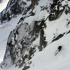
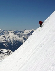
Mt Adams, High-level Orbit on Skis Amar Andalkar, Dave Coleman, my brother Josh and I set out near nightfall on June 13, 2008 to a camp below treeline on the south side of Mount Adams. The next morning we awoke to clear blue skis and perfect conditions for moving fast. We left with small packs for a counter-clockwise orbit around the mountain. This route took us below the mysterious Klickitat Headwall, over the sinuous Victory and Battlement Ridges, and led us star-struck beneath the Wilson Icefall, Lyman Glaciers, and Lava Headwall until we reached the North Face routes. The day had warmed considerably and a settling snowpack kept us on our toes. Since most of the route from the West Face onward is very moderate, we made extremely fast work of it, arriving back at our tent as the sun was beginning to set. The next day we backtracked and skied the Avalanche Glacier Headwall before skiing back out to our cars. -Jason Hummel (The opening photo on this page shows David Coleman on the Mount Adams high-level orbit.) Jack Mountain, South Face, Ski Descent On June 14, 2008, Eric Wehrly and I hiked and skied from the North Cascades Highway to the saddle east of Crater Mountain, above the Jerry Glacier. We made camp next to Jerry Lakes after a nice evening ski descent. The next morning we approached the South Face of Jack, climbing above a cloud layer and hoping to find the best ski line. We were exuberant when an easy scramble through the cliff bands toward the east side of the face yielded a tongue of snow. The sustained fall line of the south face led us to the ridge above the Nohokomeen Glacier, a short scramble from the summit. A visit to the summit, amazing steep turns, one small rappel followed by a downclimb, and a ski jump of the moat below the cliffs delivered us from the upper face. Due to time constraints, we immediately returned to our camp at Jerry Lakes. While we skied the most aesthetic slopes from the top, much fall line remained to Crater Creek. From camp, we donned skins and climbed to the col above Jerry Glacier, whence we savoured skiing the south-facing slopes of Crater Mountain before another hike through the woods. -Sky Sjue |
|
|
|||||||||||||||||||||||||||||||||||||||||||||
| Continued 1 | 2 | 3 | 4 | Next>> |
|||||||||||||||||||||||||||||||||||||||||||||||
| ©2009 Northwest Mountaineering Journal | |||||||||||||||||||||||||||||||||||||||||||||||
| Site design by Lowell Skoog |
