|
|
||||||||||||
 |
|||||||||||||
 |
|||||||||||||
|
|||||||||||||
|
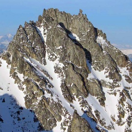
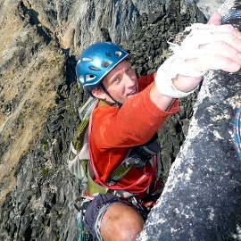
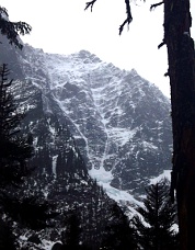
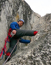
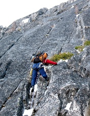
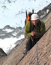
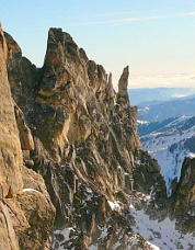
On September 16, 2008, Tim Halder and I climbed a line on the SW Face of Sherpa Peak that we thought provided a more aesthetic and enjoyable way up the mountain than the West Ridge route. Leaving the Esmeralda Basin trailhead we hurried over Longs Pass and across Ingalls Creek to the basin below Sherpa Peak. The approach is the same as for the West Ridge, except that you take a right turn uphill of the obvious tower south of Sherpa. After the right turn, scramble 150ft up easy class 3 to cross a minor rib, then take a left turn and head up an easy gully a few hundred feet to the west face of a rib that descends SW from the true summit. To save weight we climbed with a doubled half-rope, so our pitches were 100ft or less. We simul-climbed a blocky pitch of 4th and easy 5th class terrain to a ledge where the face steepened. Pitch 2 climbed an easy dihedral flanked with flakes (85ft, 5.5 or 5.6). Pitch 3 climbed a hand-crack and some face moves to a small alcove at the base of a chimney (90ft, 5.7). Pitch 4 climbed the chimney past overhanging chockstones. Pitch 5 climbed straight up to the top of the tower that caps this spur rib of Sherpa Peak (90ft, 5.7 or 5.8). From the top of the tower there are several options. The easiest is to climb one more pitch, heading north, to the true summit. However, the final south face of the true summit is riddled with interesting crack systems. (Later conversations indicate that a several parties have climbed lines on this face.) After descending slightly from the tower, we climbed three pitches up the right side of the face, including some 5.8-ish hand cracks and an airy traverse. On reaching the summit ridge, there was a short drop down to the north side of the mountain then back up to the true summit. II, 5.8 -Ben Kunz
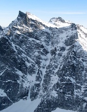
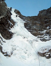
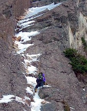
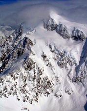
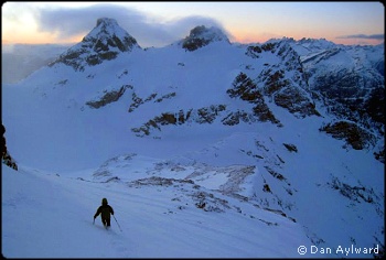
Tower Mountain, SE Ridge, New Route A fabulous weather window opened up so Blake Herrington and I headed to the North Cascades, hoping to climb a new line on Tower Mountain on September 28, 2008. We parked at the Swamp Creek pull-out, crossed the creek, headed up the southwest shoulder of Mt Hardy, and traversed the flanks of Hardy to the Pacific Crest Trail (PCT) where we found good camping by a water source. The next morning, we hiked east on the PCT and ascended a gully to the ridge separating the sweeping NE Face of Tower from its gentler southern slopes. Fearing icy cracks on the NE Face due to a recent snow and ice storm, noting the late hour, and feeling rather intimidated by dramatic NE Face, we opted to climb the SE ridge instead. We scrambled on or near the ridge crest until we reached the base of a 50 meter headwall. I led this first pitch, linking cracks on solid and clean rock (5.7). We scrambled to the base of the next wall, where Blake led a short hand crack to a large ledge (5.7) below the final headwall. Blake chose a line left of the center of this feature, leading solid orange rock (5.9+) to the base of a dihedral. Blake graciously let me lead the stellar final pitch, which followed a thin crack up a solid, clean, vertical dihedral (5.10) and ended just a few steps from the summit. We rappelled the route and retraced our steps down to the PCT. We opted to hike the PCT South to Rainy Pass on the way out, completing our alpine circuit. (Editor’s note: This route is east of the rib climbed by Joe Catellani and Gordy Skoog in 1989.) II, 5.10 -Rad Roberts Buck Mountain, North Face, New Route On December 4, 2008, Dan Cappellini and I climbed a new route on the North Face of Buck Mountain that we called “Buckshot”. We belayed the first four rope lengths (WI3, WI4, WI4+ and WI3), followed by three simul-climbing blocks featuring many WI2/3 sections separated by snow slopes. Late in the day, we reached overhangs at the head of the main gully, down-climbed a couple hundred feet and worked right out of the gully through steep sugar snow and neve for several hundred feet to a belay. We climbed up and left two pitches (a bit of M4 or M5) in the dark to reach the ridge west of the summit. We descended the west slopes back to the tent on the moraine. In retrospect, we should have exited the gully via a ramp system to the left, which would have been more sustained and aesthetic, and continued to the true summit. There are other potential winter routes on this face, including a line of ice smears directly up the north face. Ice forms early and climbers willing to play roulette with marginal road conditions will be rewarded. Watch for cornices (which were unusually small during our climb) and wind deposition. (Editor’s note: Recent reports indicate that the “North Face” route climbed by Cal Folsom and Mark Moore in September 1976 followed the steep and prominent North Ridge east of the Capellini-Larson route.) IV, WI4+, M4/5 -Rolf Larson Dragontail Peak, Backbone Ridge, First Winter Ascent On January 16, 2009, Ade Miller and John Plotz completed the first winter ascent of Backbone Ridge on Dragontail Peak, following the Fin Direct left-hand variation. The climb was made during a period of high pressure with a temperature inversion following a week of heavy rain that consolidated the snowpack. From a camp at Colchuck Lake, the pair hiked to the base of the route before dawn. They geared up and simul-climbed snow to the 5.6 corner a pitch below the crux off-width. After some mixed climbing to a tree anchor, they switched to rock shoes and climbed the corner to the base of the off-width, which was mostly dry. The off-width was climbed with a mixture of free and aid moves protected with a #6 Camelot. From the top of that pitch, the wall above appeared largely free of snow. The pair free-climbed the 5.8 pitches above the off-width then simul-climbed 4th class terrain to the base of The Fin. On The Fin they encountered more verglas on the slabs and icing in the cracks then they had seen lower on the face. After two pitches, conditions forced them to take the 1974 left-hand variation on The Fin. They followed this variation to the crest of The Fin, then switched to boots to traverse loose and icy ledges on the north side for a pitch (one point of aid) before returning to the crest. In darkness, they switched back to rock shoes to follow the crest to the summit. They arrived on top around 6 p.m. after eleven hours on the route. The descent via Aasgard Pass went smoothly and they skied out the following day. 2000ft, 5.9 A1, mixed Colonial Peak, NW Face Couloir, First Winter Ascent On January 25, 2009, Dan Aylward and Chad Kellogg completed a winter ascent of the 1973 Kloke-Simon route on the NW Face and Couloir of Colonial Peak. The climb was done in a single headlamp-to-headlamp day from the Colonial Creek campground. The difficulties of the climb were concentrated into three sections. The first was a 60m ice flow (about WI3+) that they climbed unroped. After some 50 to 60 degree snow climbing they belayed a steeper and more difficult second flow (WI4+ or 5) that required about two hours on the lead. After a somewhat easier section with mixed climbing over verglas, they emerged onto the snowfield that angles left toward the summit. They dropped technical gear and climbed about 800 vertical feet to the summit, then descended to Colonial Creek, staying far enough west to avoid cliff bands. (The opening photo on this page shows the sunset descent from Colonial Peak.) The Flagpole, First Winter Ascent On February 7, 2009, Kyle Flick and I climbed the Flagpole in amazing weather, with warm sun all day and a full moon at night. We started from the Bridge Creek campground on skis around 4:30 a.m. We skinned to the Colchuck Lake turnoff and stashed skis there, since the lean-snow conditions offered nothing worth skiing above. We cramponed up Aasgard Pass and across the upper plateau, then descended a dry gully just west of Little Annapurna. Since we’d climbed the Flagpole the previous spring we had the approach dialed in. After traversing toward Pennant Peak, we climbed one mixed pitch and one dry rock pitch to the base of the Flagpole’s bolt ladder. I clipped the ladder, using my rivet hangers on the old bolts which don’t accept carabiners of any size. The finishing 5.8 off-width move takes a #5 (new size) Camalot, followed by some easy but very exposed moves on the arete. Kyle lowered me off and clip-cleaned the ladder. By the time he touched down, it was dusk. We emerged onto the Enchantment plateau in bright moonlight. We didn’t need headlamps until we got into the trees near Colchuck Lake. We staggered back to the car at 1:30 a.m., 21 hours after starting out. -John Plotz Mount Snoqualmie, North Face, New Variation On February 8, 2009, Wayne Wallace and I did a direct two-pitch variation on Mount Snoqualmie’s Pineapple Express route. From the top of the first WI3 pitch of the standard route, we climbed directly upward on thin ice smears (first pitch of variation) and through a 3-foot-wide squeeze chimney (second pitch). From the top of the chimney, we stepped out onto a large chock-stone and joined the normal route. We named the variation “The Blue Moon” because we expect it will seldom be in climbable condition. III, WI3, M3 -Craig Gyselinck Mount Shuksan, Curtis Glacier, Ski Descent On February 14, 2009, Monika Johnson and I skied the Curtis Glacier on Mount Shuksan, descending a line south of the one skied by Sky Sjue’s party in 2008. (Editor’s note: When viewed from the west, two parallel gullies slant down and right from the north end of the Upper Curtis Glacier toward the Lower Curtis Glacier. The 2008 party skied the northernmost gully, first climbed in 1951. See see NWMJ Issue 5.) Leaving the Mount Baker ski area parking lot at 5 a.m., we cruised to Austin Pass and glided along a track into Swift Creek toward the Lake Ann saddle. After climbing to the saddle, we traversed toward the Fisher Chimneys, since this was our original objective. Upon reached the chimneys we decided they looked okay for climbing, but not for skiing. We decided to take a closer look at the two gullies between the Upper and Lower Curtis Glaciers. Both looked like good climbs, but the one on the right was more filled in so we decided to have a go. The climb was fun and the snow was inviting of a descent. Ice cliffs and seracs threaten this route from above, so it should be avoided in warmer weather. From the top of the gully we headed towards the Hourglass couloir, our second objective of the day. Being beginners at this ice climbing stuff, we belayed two rope lengths and simul-climbed the rest. Ice climbing with skis on the pack is interesting. Atop the Hourglass the weather had totally come in. We had to feel our way towards Hells Highway in a whiteout and lost a lot of time. The ski down the Curtis Glacier in whiteout conditions was slow as real and imagined exposure played mind tricks on us. Once past a couple of cruxes it was pretty darn good though. Short on time, we abandoned our third objective (the north side of Shuksan Arm) and returned to the ski area via Swift Creek. The ski out was beautiful and very peaceful as light snow was falling. -Oyvind Henningsen |
|
|
|||||||||||||||||||||||||||||||||||||||||||
| << Previous | 1 | 2 | 3 | 4 | |||||||||||||||||||||||||||||||||||||||||||||
| ©2009 Northwest Mountaineering Journal | |||||||||||||||||||||||||||||||||||||||||||||
| Site design by Lowell Skoog |
