|
|
||||||||||||
 |
|||||||||||||
 |
|||||||||||||
|
|||||||||||||
|
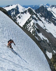
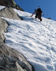
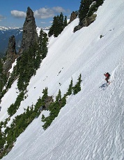
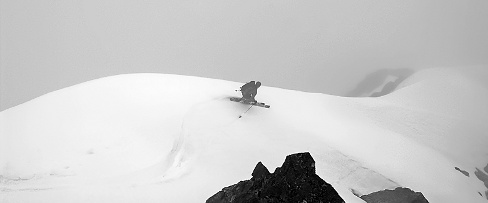
June 16, 2008 was a perfect day for spring skiing in the North Cascades; clear weather, good snow, and willing partners made me a happy boy. Jeff Rich, Eric Roose and I wanted to do something new (at least for us) so we headed up to check out the north face gully on Morning Star Peak which we’d seen on many trips up Headlee Pass. We parked at the Mountain Loop Highway and walk/skied down the Sunrise Mine road for a couple miles to the trailhead. Eric decided to make some runs in upper Wirtz Basin, while Jeff and I continued up Morning Star. The gully reared up steeper than we’d anticipated so I was glad for the excellent steps Jeff kicked, and was quite relieved to pull over the top onto a ridge crest. We wanted to climb to the summit, but the rock looked too tricky to solo in ski boots, so we settled for the ski run. The snow was perfect corn, which is the only way I would ski it since a fall would have serious consequences on the top section above cliffs. Neapolis Pizza and beer at my house in Lake Stevens finished off a perfect day. -Jim Dockery Del Campo Peak, North and East Faces, Ski Descents On a previous climb of Morning Star, Jeff Rich and I had seen how the valley leading up to Del Campo was filled with avalanche debris making for an easy approach from the north. (I wouldn’t have wanted to be there when the slabs of Morning Star let loose though.) On June 20, 2008 we were hiking the Sunrise Mine road again with our friend John Waldrop. We put skis on when we hit the debris and skinned up on a mix of snow and shredded evergreens. We climbed up onto the north ridge of Del Campo, and then traversed up and onto the east face, which we climbed to within 200 feet of the summit where a very steep little hanging snowfield dripping over a layer of ice stopped us (given the exposure I wouldn’t have skied it anyway). We skied the east face in a series of steep rolls, and then cut back north where we saw another nice looking face/gully that needed some turns so we climbed it too, this time stopping a couple hundred feet below and NW of our previous high point. Skiing out the valley was a bit sticky on all the broken trees/branches, but better than walking. (Editor’s note: Jens Kieler skied the NW Face of Del Campo on April 16, 1983. Ski descents of the North and NW Faces start at the base of Del Campo’s steep summit rocks. It appears that with ideal conditions, the East Face would be skiable from the summit.) -Jim Dockery
Fortress Mountain, SW Face, Ski Descent On June 22, 2008 Sky Sjue, Corey Bloom, Ryan Lurie and I climbed and skied the SW Face of Fortress Mountain. Camping at the trailhead, we woke up early and approached via Buck Creek Pass. The ascent was made on the far climbers-right of the SW face while the descent was near the center of the face. While skiing the route, I was caught in a large avalanche and carried 800 vertical feet down the side of the mountain, over one cliff. I was uninjured. The others soon joined me and we skied back out the way we had come, finishing some 17 hours after we started our trip. -Jason Hummel
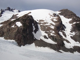
Courtney Peak, North Face, New Route On July 2, 2008, Tasha MacIlveen and I climbed a new route on the north face of Courtney Peak in the Oval Lakes area of the Chelan-Sawtooth Wilderness. The compact first pitch was a nice 5.7 warm up, a little run-out but fun. Tasha led out and pulled some thin, 5.10 moves well above a green Alien. I arrived at a complex web of tiny gear she had managed to garden into the granite. I did a dirty mantle right off the belay, yarding shamelessly on a cam. Tasha followed it and called it 5.10. Another 5.8 pitch brought us to an impasse; upward looked hard and unprotectable; rightward, we discovered a third-class ledge skirting away under a little mossy waterfall. I brought Tasha up onto the ramp we had been anticipating. We jogged up the ramp and I led out up a beautiful piece of white granite, just to the right of a steep gully. Some wandering amongst dodgy flakes brought me onto lower angle terrain—easy but very compact and without the possibility of gear. I stretched the rope all the way out, barely reaching a decent belay terrace and a few thin cracks. The sky flashed as I clipped the first pin, and I could feel the rain coming as I drove the second. By the time Tasha reached me, the wind had picked up and Oval Peak lit up with purple forks of lightning. Tasha scrambled up easy ground, then began searching for a way across a big bulge of compact rock. After much climbing, down-climbing, and backseat climbing from me, she found a delicate traverse leftward. This gained her a rib of lovely, greenish rock paralleling a snow gully to the left. I watched her climb smoothly and calmly while the sky above her exploded with bolt after bolt of lightning. She continued up the rib, climbing wet 5.8 moves with no pro for 100ft until the rope got tight. I hollered and began simul-climbing. The storm reached its full, ridiculous strength while we huddled, clipped to a couple cams, under a half-hearted roof of granite. When the storm seemed to have moved along, we started simul-climbing up through a sea of loose blocks, winding up through depressions toward the summit ridge. Tasha glowed with sunlight against the black clouds in the distance. A short scamper up the blocky ridge yielded the summit. We sauntered back to camp down the west ridge, delighted with our adventure in the wild Cascades. Grade III, 5.10, 1,200ft, Topo -Forest McBrian Natal Peak, NNE Ridge, New Route On July 13, 2008, my brother Gordy and I climbed the NNE Ridge of Natal Peak (7800ft+) on the Cascade Crest between Mount Logan and Black Peak. From a camp at the col SW of Mount Arriva, we descended an unpleasant gully to the west. The gully seems to have been scoured by flash floods and the crux is a section of crumbly rock and hardpan dirt. We managed to get down without problems and without needing a rope. After climbing the standard SW route on Indecision Peak, we initially planned to climb Natal Peak by the easiest way up the east ridge. But as we approached the peak, the NNE ridge drew us like a magnet. We figured it was worth going that way even if it meant a late return to our car. We gained the ridge around mid-height via snowfields and a major heather ramp on the left. (The lower part of the ridge had darker and dirtier rock that looked less pleasant.) The heather ramp was simple and the upper ridge was enjoyable. We did some roped simul-climbing and I’d call the route Grade I-II, class 5.0. The summit view is as good as any in the North Cascades, with Goode, Logan, Ragged Ridge, Arriva and Black towering nearby. We descended the east ridge and NE couloir. The east ridge provided quick class 3 downclimbing. The NE couloir had continuous snow, but it was only five feet wide in places. I suspect that the couloir would be a poor descent route when snow-free later in the season. -Lowell Skoog Phantom Peak, SE Face, Ski Descent Todd Karner and I skied the SE face of Phantom Peak on July 14, 2008. Starting from Ruth Creek on July 11, we approached mostly on foot via Easy Ridge and Perfect Pass over the course of two days. The next day, after climbing Mount Challenger, we skied down the chute just north of the summit to investigate the Picket Creek drainage. Encouraged by ample snow coverage we returned the following day to explore the west slope and a Beckey/Scurlock fueled suspicion that Phantom Peak might yield good turns. We traversed on skis under Crooked Thumb and Ghost Peaks and rounded Phantom’s SW ridge to see continuous smooth snow leading up the SE face at a reasonable pitch. The airy summit was a short ridge scramble above the top of the snow and we were excited to find a yellowed summit register dating back to the 1958 second ascent party. We skied perfect corn under the towering cliffs of Swiss Peak and retraced our route to camp on the Challenger Glacier. The next morning we skied the south face of Whatcom Peak and began the long hike out. -Eben Sargent (The opening photo on this page shows the SE Face of Phantom Peak from the air.) Mount Olympus, North Face and North Couloir, Ski Descent On July 24-25, 2008, Dan Helmstadter did a single-push climb of Mount Olympus that included ski descents of the North Face just below the West Peak and the North Couloir below the Snow Dome. Starting around 8:30 p.m. on July 24, Helmstadter hiked the Hoh River trail to Glacier Meadows and crossed the lower Blue Glacier at dawn. He climbed above the Snow Dome to the bergschrund below the North Face of the West Peak and ascended the right side of this face to the highest point of snow, stopping about 100 feet below the rocky summit. He skied down this slope, switched to crampons to recross the bergschrund, then climbed back up farther east and made a continuous descent back to the Snow Dome. Below the Snow Dome hut, he skied the broad NNE-facing couloir to the terminus of the Blue Glacier. He hiked out the Hoh River, completing a 45-mile day in about 21 hours round-trip. |
|
|
|||||||||||||||||||||||||||||||||||||||||||||||||
| Continued << Previous | 1 | 2 | 3 | 4 | Next>> |
|||||||||||||||||||||||||||||||||||||||||||||||||||
| ©2009 Northwest Mountaineering Journal | |||||||||||||||||||||||||||||||||||||||||||||||||||
| Site design by Lowell Skoog |
