|
|
||||||||||||
 |
|||||||||||||
 |
|||||||||||||
|
|||||||||||||
|
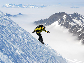
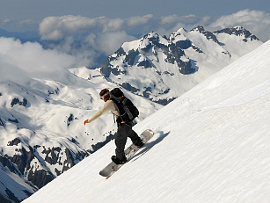
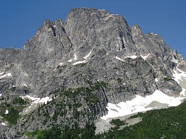
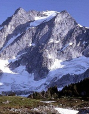
Peter Hirst, Eric Wehrly and I skied the East Face of Spickard on May 25, 2009. This route struck me as an attractive ski descent from Hozomeen Mountain one week earlier. We approached from a camp below Mount Redoubt and began our descent at 8 a.m. to minimize avalanche hazard due to the unsettled spring snowpack. The East Face featured a spring corn surface, perfect for steep turns from the summit. We stopped above the cliffs that separate the steeper upper face from the lower cirque below it, approximately 1000ft below the summit. I traversed to the south and descended a bit more just to be sure that we weren’t missing anything, until I saw an easy traverse into the lower cirque. We removed our skis and climbed to the summit again. The snow already felt dangerously rotten on the East Face by the time we returned to the summit at the ripe hour of 9:15 a.m. A complete ski descent into Silver Creek could be quite rewarding, but the logistics would certainly be more involved. We skied variably icy conditions toward Silver Lake before enjoying superb spring snow on our descent into the Depot Creek drainage. -Sky Sjue Ski descents in the Mount Olympus area From June 4-10, 2009, Kyle Miller and I visited the Mount Olympus massif via the Hoh River. Over seven days we completed several ski and snowboard descents in the region. Of note were the North Face of the Middle Peak of Olympus, North Face of Athena, SW Face of Mount Olympus, and West Face of Hugin in The Valhallas. After hiking to the Blue Glacier, we skied the North Face of the Middle Peak of Mount Olympus on our third day, after skiing the West Peak. The next day, due to poor weather, we descended the Blue Glacier from the Snow Dome, crossed over to the Hoh Glacier via Glacier Pass and ascended through fog toward Athena. Although our initial plan was the West Summit of Olympus, we couldn’t find it in the fog, but we could see Athena. During the day we ascended and descended the North Face of Athena, descended the North Face of the Middle Peak of Mount Olympus a second time, and returned to camp on the Snow Dome via Crystal Pass. On day five, clouds parted and we packed light for a one-day push into the Valhallas. To reach it, you must descend the SW Face of Mount Olympus. To that end, we skied early morning corn then traversed around ice cliffs and rock bands until we were far below Mount Tom. Previous climbing parties have traversed the Hubert Glacier over a ridge to ascend west of the highest summit of Olympus. We instead descended to the lowest point of an unnamed glacier before continuing SE through a narrow snow-filled creek canyon. At its confluence with the South Fork Hoh River, we descend to about 3700ft before finding a route up the NW flank of the Valhalla Range. Many tedious ups and downs, dead ends and fog-hindered route-finding nearly stymied us, but we pressed on. Late in the day we blindly summited Mount Hugin. Moments later we descended wonderful snow all the way to the South Fork Hoh River before reversing our route, returning to camp beneath clear night skies. Two days later we arrived back at the car, tired yet immensely satisfied by our adventures above the forests in Olympic National Park. -Jason Hummel
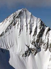
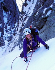
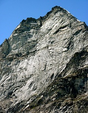
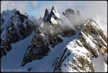
Twin Needles, North Couloir, “Thread of Ice,” New Route On June 27, 2009, Steph Abegg and Wayne Wallace climbed the 1200-ft North Couloir of the Twin Needles, dubbed the “Thread of Ice” by John Roper in 1984. Roper called the nearby North Buttress of the east spire the “Thread of Gneiss.” The buttress was attempted by Carla Firey and Jim McCarthy in 1976. They turned back due to notches and down-slab rock for which they lacked adequate protection. Wayne Wallace and Mike Layton attempted the buttress in 2007. They encountered a rotten fault line that was almost impassable, and deemed the route not worth the risk. Steph Abegg admired the snow/ice couloir during an August 2008 trip and she recruited Wallace to give it a try. They approached the Southern Pickets via The Barrier and crossed Himmelhorn Col to access the climbing route. With continuous snow/ice conditions, the couloir posed no major problems and the climb ended with a bit of 5.7 rock. Abegg reported that the route is very dependent on conditions. A melt-freeze cycle could result in a fine water-ice route, heavy snows could create the potential for a challenging ski descent, or patchy/non-existant snow and ice could make the ascent impossible. (The opening photo on this page shows the Twin Needles from the air.)
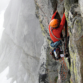
South Nesakwatch Spire, East Buttress, New Route On June 27, 2009, Drew Brayshaw, Marc-Andre Leclerc, and Jesse Mason climbed the East Buttress of South Nesakwatch Spire. The Nesakwatch Spires are located between Mount Rexford and the Illusion Peaks north of the U.S.-Canada Border. From the bergschrund at the base of the Priest-Coupe couloir the party accessed the rock and climbed the buttress closely right of the couloir. The route to the summit involved nine pitches ranging from 4th class to 5.9, mostly in the 5.7-5.8 range. The 1974 Culbert guide shows a line on the east face of the South Spire to the right of this buttress. Other guidebooks have not documented rock routes on this side of the spire. III, 5.9 Mount Stuart, NW Face, “Gorillas in the Mist,” New Route On July 8, 2009, Sol Wertkin, Jens Holsten and I climbed a new route on Mount Stuart, a Cascades icon known for 3,000-ft climbs on excellent stone or dependable ice. I’d assumed Stuart’s major faces and ridges had been completed until being shown photos of an unclimbed 1000-ft buttress towering over the rock glacier between Stuart Pass and Goat Pass. While winter trip-planning, Sol and I dubbed this the “West Face Wall.” We dreamed of sunny rock and received emails from two parties who’d attempted the climb. Phrases like “giant roof,” “full pitch of thin nailing” and “all day—at least” brought cautious inspiration. Jens had attempted the wall in 2006, and joined us last-minute. We set off as a trio at 5 a.m. Above treeline, we entered a swirling fog which made locating the climb an adventure in its own right. Jens had predicted sunny skies, and Sol’s wedding anniversary was the next day. Consequently, our gear consisted of wind shirts, climbing equipment, and two daypacks. We started up a splitter crack, just right of looming orange overhangs. Two pitches of corners and arętes led us to a bolted anchor stamped “1993.” We’d later hear from the 1993 ascensionists, whose big-wall-style attempt had climbed three-fourths of the wall. Jens unlocked the key route-finding puzzle on pitch 3, leading the rightward “monkey traverse” while pausing to trundle, mid-crux. We followed flakes and corners for six more foggy pitches until joining the West Ridge amid decreasing temperatures and visibility. While negotiating icy towers, Sol and I were separated from Jens, who had soloed while we’d simuled. Hours of nervous shouting amid howling winds resulted in three sore throats but our eventual reunion. Under darkening gloom, we settled for a bivy and some hardcore cuddling. The coldest night of our lives (but best spooning) ended at 4 a.m. We reached a sunrise summit under clearing conditions, fingers still too numb to manipulate iced-up cams. The Sherpa Glacier descent and hike out went quickly, and we knew friends would be worried. Bouncing down the dirt road to town, we encountered an all-star rescue squad, hastily assembled by Sol’s nervous wife. Happy to have her husband returned, Jens and I were treated to the best home-made sandwiches of our lives. Marital bliss preserved, we avoided the potential for jealousy and never once mentioned the spooning. IV+, 5.11 -Blake Herrington
Repulse Peak, NE Rib, New Route On July 11, 2009, Gordy Skoog and I climbed the broad NE Rib of Repulse Peak (7923ft), located on the Granite-Grizzly Creek divide between Black and Fischer peaks. We approached from Highway 20 via the unnamed valley bearing SW opposite Swamp Creek. The ascent started from above the seasonal avalanche fan where we bypassed waterfalls to the left, then moved right, scrambling about 500 vertical feet to the top of a broad, sparsely-treed buttress which ends at a 100-ft vertical step. A left-trending, low-5th lead up this step brought us to 300ft of 4th-class crest scrambling and the start of consistently steeper ground in the center of the NE face proper. Solid, in-cut, low-5th simul-climbing for 400ft up the right-side of a dished face was followed by three 150-ft roped pitches on the solid, blocky rib with climbing to 5.6. After crossing a small seasonal snow patch, another 400ft of airy, low-5th, in-cut face climbing on the broad rib led directly to the remnant summit cornice. We found the original 1971 summit register (a Swiss, 35-mm film canister) left by the Firey first-ascent party, thankful that they did not have digital cameras back then. We took in the sweeping view of the Black Peak’s North face and the fast-melting Shelockum Glacier, with grand views down Grizzly Creek and beyond to Goode’s NE flanks. Loose, gravelly ledges and ramps led down the South Ridge to a fault-gouged notch, where we followed seasonal snow, moriane and sub-alpine thickets back to the basin floor, using two short tree rappels. We crossed Granite Creek just as our eyes adjusted to complete darkness then trudged back to the highway under a starry sky sans headlamps. Using early season snow would make the descent and approach to this otherwise worthy climb less repulsive. Overall, the rock quality is good on the peak’s north aspects; very different from conditions found on the South Ridge descent. Many route options appear possible on the upper rib/face to climbers’ left of our ascent route. III, 5.6 -Crispin Prahl
Dome Peak, SE Face of SE Peak (“Gran Torino”), New Route On July 15, 2009, Mike Layton and Wayne Wallace climbed the 1800-ft SE Face of the SE summit (8788ft) of Dome Peak, a route they called “Gran Torino.” The pair approached the climb from the Stehekin River, hiking Agnes and Spruce Creeks then climbing out of Spruce Creek to the Spruce-Icy col south of Agnes Mountain. Traversing west, they passed beneath the South Face of Sinister Peak and camped below Dome Peak at the end of their third day. Before dawn on the fourth day, they crossed to the left side of the glacier and gained ramps at the base of the face. They roped up and headed for a “tilted block” then climbed several pitches, mostly cracks and dihedrals, eventually moving right toward the “megadihedral,” the major corner system in the center of the face. The megadihedral didn’t offer much protection so they face-climbed on chickenheads and found gear on the face, which Layton described as “fun, thoughtful, and a little scary.” Two pitches of cracks led to a steep ramp cutting rightward across the face. They took the ramp for one pitch then headed up again, following cracks. They completed the route to the SE Peak in 4-1/2 hours and descended the unclimbed East Ridge (about 5.6) which took nearly as long as the climb. They moved camp closer to Gunsight Peak and after a rest day did the Gun Runner Traverse to complete their adventure. They returned to Stehekin the way they came, completing most of the route in a long morning after an early start to catch the shuttle back to the ferry landing. IV, 5.9+, 15 pitches
Mount Formidable, Complete NE Buttress, New Variation On July 22, 2009, Forest McBrian and I climbed the complete NE Buttress of Mount Formidable. This feature splits the Middle Cascade Glacier from the Formidable Glacier on the mountain’s NE aspect. After approaching via the Ptarmigan Traverse from Cascade Pass, the route began where a moat crossing was possible—at the left edge of a sidewalk/ramp system, close to a small, white crystalline band. From here, we climbed about 1000ft of new terrain, a mixture of rock to 5.9 and steep heather, before intersecting the 1962 route. The upper half of route began with an amazing snow arete, before continuing over the loose East Ridge pyramid. We then traversed a Sierra-esque knife-edge ridge to the summit. Descent was made by crossing the south face, generally trending SE towards the head of Flat Creek, where we ascended to regain the Ptarmigan Traverse and the route back to our campsite. All things considered, our route is similar to the NE Buttress (1957) of nearby Johannesburg except that it is not guarded by 2000ft+ of heinous bushwacking and the rock quality is better on Formidable. The exposed, but safe position on the buttress crest between two very active glaciers gives the route its appeal. III+ 5.9 -Kurt Hicks |
|
|
|||||||||||||||||||||||||||||||||||||||||||||||||||||||||||||||||||||||||||||||||
| Continued << Previous | 1 | 2 | 3 | 4 | 5 | Next>> |
|||||||||||||||||||||||||||||||||||||||||||||||||||||||||||||||||||||||||||||||||||
| ©2010 Northwest Mountaineering Journal | |||||||||||||||||||||||||||||||||||||||||||||||||||||||||||||||||||||||||||||||||||
| Site design by Lowell Skoog |
