|
|
||||||||||||
 |
|||||||||||||
 |
|||||||||||||
|
|||||||||||||
|
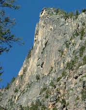
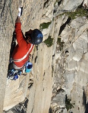
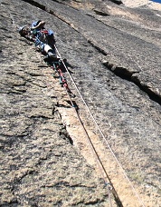
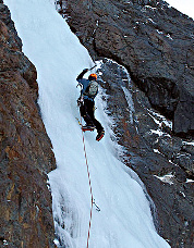
Driving home after an outing at Washington Pass in the summer of 2007, Erik Lawson and I spotted a massive cave on the north side of the North Cascades Highway. Directly uphill from milepost 166, this cave punctuates a sizeable wall with two large ledges. The approach looked shorter than the massive slogs up to the Early Winter Spires. We were instantly hooked by what was, to us, unknown terrain close to the road. Returning in August and September of 2007, Erik and I began what became a three-year project that barely fit into the narrowing cracks of our professional, familial, and personal lives: In 2007, we searched for free passages up from the right end of the lower ledge. We gained the upper ledge in two pitches of 5.10 and 5.11. The climbing from the upper ledge to the cave involved two pitches of 5.11, with mandatory free climbing at 5.11c just below the cave. In 2008, we returned to free more of the first four pitches and to finish the climbing above the cave. We ascended from the cave’s left side, which Erik followed cleanly at 5.11, and reached the top of the wall in three more pitches. On October 4, 2009, we managed to free all of the pitches and walked off left to descend. The route can be approached in an hour by ascending directly up a gully from milepost 166. It ascends from the right end of the lower ledge to the left edge of the Supercave in four pitches (5.10, 5.11, 5.11, and 5.11c). A 5.11 pitch exits the left side of the cave, followed by three easier pitches to the top of the wall. To descend, walk off left or rappel the entire wall in 60-meter increments. Hopefully future parties will add a three-pitch extension up and left of the Supercave and out to the summit blocks. This terrain covers beautiful golden granite with an unmistakable black water streak striping a pitch-long flake. This flake competes with the Supercave as the most striking feature of the wall. IV, 5.11c -Lee Arden Pete Mount Baker, Roosevelt Glacier Cirque, New Ice Routes On December 9-10, 2009, Jeff Street and I went to Mount Baker with the intention of climbing the Cosley-Houston route on Colfax peak. While driving to the trailhead, the view of Mount Baker revealed a cirque below the Roosevelt Glacier with numerous ice climbs. We saw a row of about eight routes close to one another, ranging from a set of easier WI3 climbs on the left to a few WI4 climbs on the right. Photos of this region taken in 2006 show that this cirque was previously covered by an ice tongue that has receded, exposing a rock band and ice routes. We abandoned our attempt on Colfax to take a closer look at these routes. We camped at Mirkwood campground and the next day traversed the Roosevelt Glacier towards the cirque at about 5200ft. We focused our attention on two areas at roughly the same elevation. The area on the left had three WI2/3 climbs. We climbed all of these routes including the rightmost which we called “Emerald City” (WI3). The area on the right had four more difficult and dramatic lines. We attempted the leftmost route, probably WI5, but it was raining too much so we bailed and moved to next climb over to the right. We called this route “Rough Rider” (two pitches, WI3+/4 and WI2/2+).
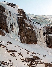
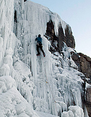
Given the elevation, these ice climbs should form each winter. In February 2010, Jeff Street returned to the area and noticed some of the ice routes still in climbable shape. -Shannon Pahl Mount Shuksan, West of the North Face, Ski Descent When we skied the couloir that offered a direct, titillating linkup from the upper North Face of Shuksan to the White Salmon drainage two years ago, Eric Wehrly and I couldn’t help but note, after the fact, that there was a more direct route available. The line of maximum continuity awaited, to the west of the standard upper North Face from gentle slopes high on the Hanging Glacier, flirting with exhilarating exposure above the Northwest Couloir. On February 6, 2010, a convergence of conditions and companions allowed Eric and I to share this vision with Alex Gibbs, Casey Ruff, and Andy Traslin. We climbed the route in its entirety to our high point atop the North Shoulder.
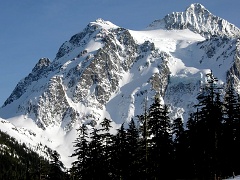
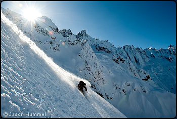
The entrance, more west-facing than the top of the standard North Face route, was wind-blasted and icy. Alex dislocated his shoulder early in the descent, but Andy and Casey were able to help him to an island of safety where we rigged his arm into a makeshift sling. He made an impressive effort to ski the rest of the descent on his telemark gear with only one arm available, indubitably aided by the very favorable powder conditions. Inspired by the lyrics of Keith Elam, who had a heart attack on the day of our descent and succumbed to cancer in April, we dubbed our route “The Anointment;” the idea is that this line represents a beautiful and logical progression of sustained steep skiing without any artifice. I could not be more pleased to have skied this line, Cascadian quintessence of steep skiing. -Sky Sjue Three Fingers, South Peak, Summit Ski Descent On February 6-7, 2010, Jason and Josh Hummel skied to Three Fingers Mountain from the trailhead, taking advantage of unusually good road access during the El Niño winter. While low-elevation snow was scarce, high on the peak it blanketed the summit rocks. After a night in the lookout, they skied off the south summit of the peak, a pitch normally ascended by ladders. Reaching easier slopes, they descended the West Couloir to the Queest-Alb Glacier then traversed to the Middle Peak. Icy conditions prevented them from skiing from its summit, but they began their ski descent a few feet below. Picket Range, Winter Ski Traverse From February 17-22, 2010, Forest McBrian and Jason Hummel completed a six-day, south-to-north ski traverse of the Picket Range. Using a split-board, Kyle Miller started the trip with them but turned back on Stetattle Ridge due to snow stability concerns. This was the second time (the first in winter) that the range had been traversed on skis. The first ski traverse was made from north to south by Lowell and Carl Skoog with Jens Kieler in mid-May 1985. Camping without tents, McBrian and Hummel spent nights at Sourdough Mountain, Elephant Butte, McMillan Cirque, Challenger Arm, and Chilliwack Pass.
The party varied from the 1985 Skoog-Kieler route in two sections. From McMillan Cirque, they climbed the basin SE of Mount Fury and worked NE as directly as possible to Luna Col. The 1985 party traversed from Luna Col near the ridgeline to Mount Fury, skied from its summit, then passed over Fury’s SE Peak to reach McMillan Cirque, making one rappel. From Perfect Pass, McBrian and Hummel followed Easy Ridge westward and continued over Mineral Mountain and Chilliwack Pass to Hannegan Pass. The 1985 party took a lower route, following the Chilliwack River from Hannegan Pass to Whatcom Pass. The winter traverse was made in exceptionally fine weather during the El Niño year of 2010. (The opening photo on this page shows Forest McBrian skiing into Luna Cirque below Mount Fury.) Colonial Peak, North Face, “First Date,” New Route
On February 20, 2010, I met up with Beau Carillo to commence an ascent of the North Face of Colonial Peak. Using binoculars, we scoped out conditions on the mountain from a lookout point a few miles from Colonial Creek. After deciding on our route, we hiked to the base through a beautiful forest on a bluebird day. We cramponed up the avalanche gully with towering ice daggers above us and made our bivy site around 3 p.m. We awoke at 4:45 a.m. to another bluebird day. Things could have only been better if I had remembered to bring my helmet. We started climbing from our bivy and immediately encountered some WI3. We chose not to rope up for this climb. Most of the route is steep snow (50-75 degrees). There are numerous sections of AI3 ice with some easier mixed climbing on the route. After the couloir the route steepens until the final summit block. We ate a food bar at the summit and, after enjoying the views, traversed back to our bivy site. After stumbling back through the woods, we reached our vehicle at 2:30 p.m. This is not a story of romance or love. We chose to name the route “First Date” because Beau and I had never met or climbed together before this. It was a great outing. -Geoff Cecil Pyramid Peak, NE Face, New Route
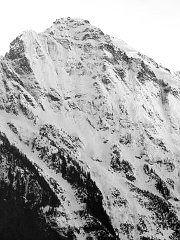
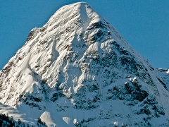
On February 21, 2010, Wayne Wallace and I climbed nice line on the NE side of Pyramid Peak. Though the climb was a minor obsession of mine, Wayne was instrumental in getting us off the ground. We belayed eight pitches to the junction with the north ridge then stomped up to the summit from there. Five pitches were “full-value” climbing and the other three were “change”. It’s hard to rate the water ice crux, but it seemed like a short but steep WI5 and was tough enough that Wayne had to take a bit of rope tension to put in a screw and de-pump. The other pitches probably clocked in at snice/ice 4 to 4+ with some feet on the rock, but I decline to give it a mixed grade to keep things simple. As shown in the accompanying photo (click for topo), a direct start is still in the offing. Recommended gear includes nuts and cams to 3 inches, knifeblade and lost arrow pitons, a handful of shorter screws and a Specter. Expect some runouts. III, WI5, A0 (1 point) -Rolf Larson Sperry Peak, NE Face, New Route
On February 21, 2010, Ade Miller and Mark Bunker climbed the NE Face of Sperry Peak. Their route climbed the rib to the left of the central couloir on the face. Their original aim was the couloir itself, but poor snow conditions and an impressive cornice near the summit deterred them. Low on the route they found perfect neve, but above about 5000ft there was a lot of soft snow. They wallowed and trenched their way up the upper sections of the rib to reach the East Ridge, which they followed to the summit. Miller reported that the line seemed improbably steep for a snow route. Wet conditions had glued snow to some of the steeper rock sections of the route. Ice gear and pickets proved useless. The party recommended lots of slings for trees plus some rock gear. |
|
|
|||||||||||||||||||||||||||||||||||||||||||||||||||||||||||||||||||||||||||||
| << Previous | 1 | 2 | 3 | 4 | 5 | Next>> | |||||||||||||||||||||||||||||||||||||||||||||||||||||||||||||||||||||||||||||||
| ©2010 Northwest Mountaineering Journal | |||||||||||||||||||||||||||||||||||||||||||||||||||||||||||||||||||||||||||||||
| Site design by Lowell Skoog |
