
|
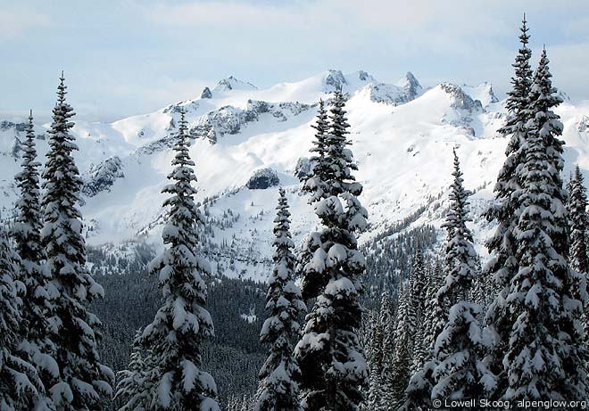
| Mount Daniel from Surprise Gap on the second morning, March 2007. Three hours later it began to rain. (Map, 400kb) |
|
In June of 2002, I skied with three friends from Snoqualmie Pass to Mount Daniel and the Cle Elum River, a trip we called the Alpine Lakes Traverse. The trip covered some high and rugged country, passing over Chikamin Ridge, the Overcoat Glacier, Mount Hinman and Mount Daniel. This country is best skied in late spring, when days are longer and the weather and snow are more stable. We finished the trip at the Cle Elum River, the usual access route to Mount Daniel. When I decided to try to complete the Cascade Crest on skis, I needed to close the gap between Stevens Pass and my earlier trip. The section from Stevens Pass to Deception Pass and the Cle Elum River is lower than the Alpine Lakes Traverse and is better skied in winter than in spring.
It's likely that the crest between Stevens Pass and Deception Pass was skied many years ago. In the winter of 1937-38, the Stevens Pass ski area opened with a single rope tow. The Forest Service and Civilian Conservation Corps completed a ski hut at the pass that year and the road was plowed throughout the winter from the Wenatchee side. West-side skiers took the train from Scenic through the Cascade Tunnel to Berne on the east side and then rode in an old bus to the summit. At the end of the day, they would ski down the snow-covered highway back to their cars at Scenic. In 1940, the War Department and the National Ski Patrol agreed to an arrangement in which the Ski Patrol would "become thoroughly familiar with local terrain" in order to furnish guides to the Army and assist in civil defense and search and rescue. The Ski Patrol divided the Cascade Crest into 10-mile sections, each a Patrol region. Dwight Watson chose the Stevens Pass region and he made many scouting trips south of the pass during World War II. Patrol activites included map making, equipment testing, and winter training. Watson led the map making work. Ome Daiber and Will Borrow worked on equipment. Lyle St. Louis coordinated search and rescue efforts to recover aviators who bailed out of military aircraft over the Cascades and Olympics during the war. When Paul Ekman and I planned our trip from Stevens Pass to Deception Pass, we decided to follow the Pacific Crest Trail. The trail is well located in this section of the Cascades. It stays fairly high and travels through scenic country without going to a lot of extra effort. The ideal route to connect the Crest Trail with my 2002 Alpine Lakes Traverse would be to stay close to the divide from Deception Pass to Mount Daniel. But this would require more time than we had available. We planned a two-day trip, intending to reach the Cathedral Rock trailhead on the Cle Elum River where I had ended the Alpine Lakes Traverse. We would then ski the road to a car parked at Salmon La Sac. We wanted to do it before the Cle Elum River road melted out, so we aimed for late March, 2007 (see map, 400kb).
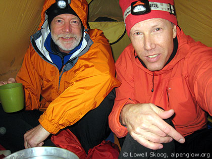
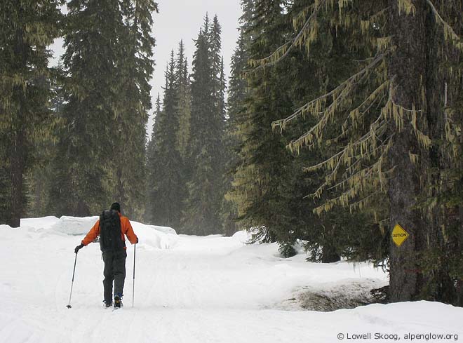
On Thursday, March 22, Paul and I left Seattle separately at 4 a.m. and drove to a rendezvous at Snoqualmie Pass. We continued to Salmon La Sac, where we left Paul's car, then drove over Blewett/Swauk Pass to Leavenworth and reached Stevens Pass from the east around 9 a.m. About a foot of new snow had fallen at the pass two days earlier. The forecast called for a window of not-too-warm, not-too-wet weather before soaking rain arrived on Saturday. The outlook was good enough (just barely) to prompt us to go. At Stevens Pass, a snow shower was just ending and there was no sign of rain yet, so we decided to start out. Over the next eight hours, we skied to Josephine Lake and followed the Crest Trail past Hope Lake and Trap Lake to a camp near Surprise Lake. The trail-breaking was harder than we hoped for, but not bad enough to turn us back. Snowfall resumed in the afternoon. We set up our tent in the evening and hoped the snow wouldn't turn to rain. After a night of light snowfall, we awoke Friday morning to clear skies. Elated, we packed up and skied to Surprise Gap, the high point of the route. We admired the view of Mount Daniel to the south and Glacier Peak to the north, but watched as a thick blanket of clouds approached from the west. Heavy snow gave us poor skiing down to Deception Lakes. In the woods of Deception Creek, the snowy trees that looked so pretty the previous day began dripping heavily on us. Near Deception Pass, the clouds began dripping as well. We descended to Hyas Lake in our rain gear and skied a tedious three miles to the end of the Cle Elum River road. In planning this trip, I always thought of the Cathedral Rock trailhead as the end of the route, since that's where it joins my 2002 Alpine Lakes Traverse. Paul and I discussed the Cle Elum River road casually, but we never got much beyond saying "We'll just have to deal with it." Reality now asserted itself -- at the end of the road we were still thirteen miles from our car, there was no sign of recent snowmobile traffic, and it was now raining in earnest. We ducked into a Forest Service toilet to rest, eat, and prepare ourselves for the final push. About 4 p.m. we started down the road. We soon found fresh snowmobile tracks, but the valley was so flat that we couldn't glide much. I set my GPS to indicate the distance to our car. It showed ten miles as the satellite flies, but the true road distance was more and those long miles passed at a crawl. Finally, about half-way down the valley, the slope increased and we could start gliding. Near dusk we reached Paul's car, soaked to the skin. We were tired but satisfied. Our window of opportunity for this trip had been little more than a peep-hole, but it was enough. --Lowell Skoog
|
||||||||||||||||||||
|
Previous | Next | Overview - Skiing the Cascade Crest | The Alpenglow Gallery |


